


Digital mapping tools like Google Street View often obscure the realities of cities and concentrate their resources in the wealthiest countries, effectively ‘erasing’ some places from the global map.
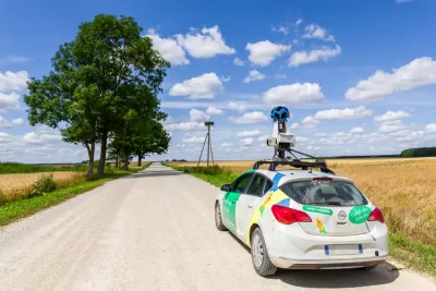
Writing in ArchDaily, Matthew Maganga highlights the failures of modern mapping tools such as Google Street View, which can literally leave some places off the map and perpetuate unequal systems of power. “Historically, far before the realm of today’s digital technologies, mapping has functioned as a method of control. This control seeped out into how unmapped spaces were viewed, as European colonial powers termed unmapped land as terra nullius and sought to, through mapping, further their imperial commercial interests.”
Today, “In a ‘post-colonial’ twenty-first-century, neo-colonialism means that some of these unmapped cities are greatly reliant on a tourism industry that seeks to attract travelers mainly from the countries of the Global North.” According to Maganga, “In Africa, only 13 countries have been mapped by Google Street View. Almost all of Central America has yet to be mapped. Much of Asia and the Middle East is similarly unavailable on Google Street View.”
In other situations, Google Street View only shows the “sanitized” parts of a city, writes Maganga. In some places, Google Street View omits informal settlements. “This form of urban cartography essentially ignores those who live in examples of less ‘formal’ architecture, exacerbating what can only be termed as an urban digital divide where places not visible on platforms such as Google Street View are in turn then forgotten by governments and political powers.”
Maganga cautions that it’s crucial to remember that “Mapping has always been biased – it’s far from a neutral endeavor.” Planners and cartographers must remember that their tools, if not deployed with care, can reinforce systems of injustice.
FULL STORY: Invisible Landscapes: When Digital Tools Fail to Document

Top Websites for Urban Planning - 2022
Every year, Planetizen collects the websites breaking new digital ground in the world of planning and related fields.

Analyzing Lynch's City Imageability in the Digital Age
Mahbubur Meenar of Rowan University writes about a recent article he co-authored in the Journal of Planning Education and Research

Placekeeping: Setting a New Precedent for City Planners
How a preservation-based approach to redevelopment and urban design can prevent displacement and honor legacy communities.

Study: Maui’s Plan to Convert Vacation Rentals to Long-Term Housing Could Cause Nearly $1 Billion Economic Loss
The plan would reduce visitor accommodation by 25,% resulting in 1,900 jobs lost.

North Texas Transit Leaders Tout Benefits of TOD for Growing Region
At a summit focused on transit-oriented development, policymakers discussed how North Texas’ expanded light rail system can serve as a tool for economic growth.

Using Old Oil and Gas Wells for Green Energy Storage
Penn State researchers have found that repurposing abandoned oil and gas wells for geothermal-assisted compressed-air energy storage can boost efficiency, reduce environmental risks, and support clean energy and job transitions.

Santa Barbara Could Build Housing on County Land
County supervisors moved forward a proposal to build workforce housing on two county-owned parcels.

San Mateo Formally Opposes Freeway Project
The city council will send a letter to Caltrans urging the agency to reconsider a plan to expand the 101 through the city of San Mateo.

A Bronx Community Fights to Have its Voice Heard
After organizing and giving input for decades, the community around the Kingsbridge Armory might actually see it redeveloped — and they want to continue to have a say in how it goes.
Urban Design for Planners 1: Software Tools
This six-course series explores essential urban design concepts using open source software and equips planners with the tools they need to participate fully in the urban design process.
Planning for Universal Design
Learn the tools for implementing Universal Design in planning regulations.
Ascent Environmental
Borough of Carlisle
Caltrans
Institute for Housing and Urban Development Studies (IHS)
City of Grandview
Harvard GSD Executive Education
Toledo-Lucas County Plan Commissions
Salt Lake City
NYU Wagner Graduate School of Public Service