


A new mapping tool visualizes the unequal distribution of urban trees in U.S. cities.
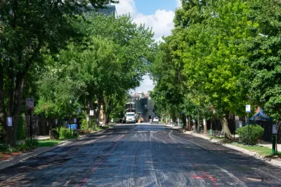
An analysis from American Forests, a conservation nonprofit, has found glaring discrepancies in the availability of trees in low-income neighborhoods and communities of color, writes Linda Poon for Bloomberg CityLab. According to the study, "[n]eighborhoods with a majority of people of color have, on average, 33% less tree canopy than majority-white communities," while "[t]he poorest neighborhoods, where 90% of residents live in poverty, have 41% less coverage than the wealthiest ones."
American Forests' new project, the Tree Equity Score map, highlights the difference in tree canopy across neighborhoods, indicating that this tracks closely with social and economic characteristics. "As Jad Daley, president and CEO of American Forests, told CityLab last August, any map of tree cover in a U.S. city likely reflects its racial and socioeconomic divide." As such, "the map is meant to be a tool for advocates and local officials. The score reflects how many trees are needed in each tract based on factors like the region’s climate and population density, as well as six equity measures: income level, employment rate, race, age distribution, health outcomes and the severity of the urban heat island effect."
"Nationally, some 522 million new trees are needed for every city to reach a score of 100, according to the analysis. That could lead to the creation of more than 3.8 million jobs, curb air pollution by 56,613 tons of particulates each year, and remove 9.3 million tons of carbon from the atmosphere — equivalent to 92 million cars, the analysis estimates. It could also generate roughly $5 billion in annual ecosystem service benefits, like air quality improvement and stormwater drainage."
The tool's creators hope that the map "could be particularly helpful to cities with fewer resources and smaller budgets to conduct their own tree canopy survey."
FULL STORY: The U.S. Neighborhoods With the Greatest Tree Inequity, Mapped


Alabama: Trump Terminates Settlements for Black Communities Harmed By Raw Sewage
Trump deemed the landmark civil rights agreement “illegal DEI and environmental justice policy.”

Planetizen Federal Action Tracker
A weekly monitor of how Trump’s orders and actions are impacting planners and planning in America.

The 120 Year Old Tiny Home Villages That Sheltered San Francisco’s Earthquake Refugees
More than a century ago, San Francisco mobilized to house thousands of residents displaced by the 1906 earthquake. Could their strategy offer a model for the present?

Indy Neighborhood Group Builds Temporary Multi-Use Path
Community members, aided in part by funding from the city, repurposed a vehicle lane to create a protected bike and pedestrian path for the summer season.

Congestion Pricing Drops Holland Tunnel Delays by 65 Percent
New York City’s contentious tolling program has yielded improved traffic and roughly $100 million in revenue for the MTA.

In Both Crashes and Crime, Public Transportation is Far Safer than Driving
Contrary to popular assumptions, public transportation has far lower crash and crime rates than automobile travel. For safer communities, improve and encourage transit travel.
Urban Design for Planners 1: Software Tools
This six-course series explores essential urban design concepts using open source software and equips planners with the tools they need to participate fully in the urban design process.
Planning for Universal Design
Learn the tools for implementing Universal Design in planning regulations.
Clanton & Associates, Inc.
Jessamine County Fiscal Court
Institute for Housing and Urban Development Studies (IHS)
City of Grandview
Harvard GSD Executive Education
Toledo-Lucas County Plan Commissions
Salt Lake City
NYU Wagner Graduate School of Public Service