


Land use planning decisions are mostly made by city councils and planning commissions. But there are times when the people decide, as exemplified by the city of Monterey Park's recently approved Measure JJ.
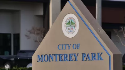
Should land use planning decisions be made by voters? There is no simple answer to this question. In the latest elections, in about 20 California cities where growth and development measures were on the ballot, voters were mostly anti-development. The city of Monterey Park was one of the few exceptions, where voters passed a land use measure allowing for focused growth in certain areas of the city.
Monterey Park lies about seven miles east of downtown Los Angeles, at the western edge of the San Gabriel Valley. Measure JJ was placed on the ballot by the Monterey Park City Council. On November 3, 2020, the measure was approved by 52.3% of voters, resulting in the adoption of a new Land Use Element (LUE) for the Monterey Park General Plan (GP). Under California law, the city’s GP must include seven elements including the LUE. Overall, the GP, particularly the LUE, constitutes the city’s vision for economic, social, and land use development. In Monterey Park, voter approval is required to adopt or amend the LUE. On March 3, 2020, voters rejected a previous version of the LUE identified as Measure II.
The LUE makes some adjustments to land uses, building sizes, and building heights. It also removed overlay zones for affordable housing in the Corporate Center Drive area that was included with Measure II. Since Measure JJ was approved by voters, the LUE would regulate land uses in the city until 2040. To ensure that the LUE is implemented, Measure JJ authorizes the City Council to adopt regulations by ordinance.
FULL STORY: Monterey Park, California, Measure JJ, Land Use Proposition (November 2020)


On the Ballot in Alameda: The End of Single-Family Zoning
Voters in Alameda, a city of nearly 80,000 people on an island in the East San Francisco Bay Area, will vote to end a prohibition on multi-family housing that has been in place since 1973.

‘Tempe Tomorrow’ Plans for Expected Population Growth
Tempe planners are preparing a General Plan update scheduled for voter approval in March 2024.

Development Streamlining Proposal Dies in San Francisco
The doomed effort was Mayor London Breed's third attempt to streamline development in the city.

Alabama: Trump Terminates Settlements for Black Communities Harmed By Raw Sewage
Trump deemed the landmark civil rights agreement “illegal DEI and environmental justice policy.”

Planetizen Federal Action Tracker
A weekly monitor of how Trump’s orders and actions are impacting planners and planning in America.

The 120 Year Old Tiny Home Villages That Sheltered San Francisco’s Earthquake Refugees
More than a century ago, San Francisco mobilized to house thousands of residents displaced by the 1906 earthquake. Could their strategy offer a model for the present?

In Both Crashes and Crime, Public Transportation is Far Safer than Driving
Contrary to popular assumptions, public transportation has far lower crash and crime rates than automobile travel. For safer communities, improve and encourage transit travel.

Report: Zoning Reforms Should Complement Nashville’s Ambitious Transit Plan
Without reform, restrictive zoning codes will limit the impact of the city’s planned transit expansion and could exclude some of the residents who depend on transit the most.

Judge Orders Release of Frozen IRA, IIJA Funding
The decision is a victory for environmental groups who charged that freezing funds for critical infrastructure and disaster response programs caused “real and irreparable harm” to communities.
Urban Design for Planners 1: Software Tools
This six-course series explores essential urban design concepts using open source software and equips planners with the tools they need to participate fully in the urban design process.
Planning for Universal Design
Learn the tools for implementing Universal Design in planning regulations.
Clanton & Associates, Inc.
Jessamine County Fiscal Court
Institute for Housing and Urban Development Studies (IHS)
City of Grandview
Harvard GSD Executive Education
Toledo-Lucas County Plan Commissions
Salt Lake City
NYU Wagner Graduate School of Public Service