


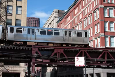
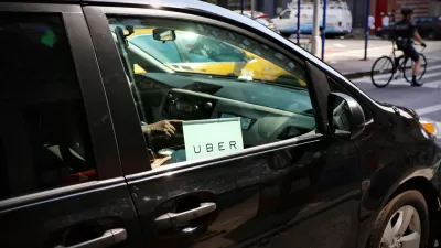
Many of the places in Chicago generating the most ride-hailing trips with services like Uber and Lyft are accessible by transit, according to new research.
Oriol Marquet, a researcher from the University of Barcelona, has published new research on the effect of land use at trip origin and destination on demand for ride-hailing services like Uber and Lyft.
The paper, titled "Spatial distribution of ride-hailing trip demand and its association with walkability and neighborhood characteristics" and published recently by the journal Cities, examined records of 32 million ride-hailing trips in the city of Chicago to identify how land use determines the use of ride-hailing services.
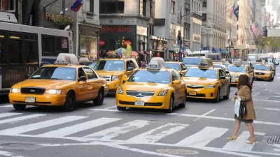
According to a Tweet posted by Marquet, the paper identifies "worrisome trends," namely, that "61% of ride-hailing trips are between highly walkable areas," and areas that offer more sustainable forms of travel. As put in the paper's abstract, "Ride-hailing is predominantly being used to travel between highly accessible areas which should be accessed using more sustainable transport modes."
The paper adds a land use angle to previous research that found evidence that many ride-hailing trips are being made at the expense of transit trips, as first revealed by a study performed by Regina Clewlow in October 2017, and contributing to a decline in transit use in urban areas.
According to another Tweet by Marquet, "Ride hailing does not seem to be a viable alternative for low-income households or for those with no car access. This suggests that even at the currently heavily-subsidized low prices, Uber and Lyft cannot substitute for public transit in low-income areas." The trip data was generated between November 1, 2018 to June 28, 2019, so the research comes with the caveat that the data and findings reflect mode choices and trip generation in the time before coronavirus.

Ride-Hailing Prices Skyrocket as the U.S. Emerges From the Pandemic
A shortage of drivers and spiking demand are driving Uber and Lyft prices higher than ever as the companies struggle to achieve profitability.
Ride-Hailing Companies Eye Public Transit Opportunities for the Wrong Reasons
Uber and Lyft say they want to improve public transit, but the focus on profit could have serious consequences.
Study: Uber and Lyft Have Been Catastrophic for Public Transit Ridership
The most damning evidence yet of how ride hailing is making urban transportation less efficient, not more.

Alabama: Trump Terminates Settlements for Black Communities Harmed By Raw Sewage
Trump deemed the landmark civil rights agreement “illegal DEI and environmental justice policy.”

Planetizen Federal Action Tracker
A weekly monitor of how Trump’s orders and actions are impacting planners and planning in America.

The 120 Year Old Tiny Home Villages That Sheltered San Francisco’s Earthquake Refugees
More than a century ago, San Francisco mobilized to house thousands of residents displaced by the 1906 earthquake. Could their strategy offer a model for the present?

In Both Crashes and Crime, Public Transportation is Far Safer than Driving
Contrary to popular assumptions, public transportation has far lower crash and crime rates than automobile travel. For safer communities, improve and encourage transit travel.

Report: Zoning Reforms Should Complement Nashville’s Ambitious Transit Plan
Without reform, restrictive zoning codes will limit the impact of the city’s planned transit expansion and could exclude some of the residents who depend on transit the most.

Judge Orders Release of Frozen IRA, IIJA Funding
The decision is a victory for environmental groups who charged that freezing funds for critical infrastructure and disaster response programs caused “real and irreparable harm” to communities.
Urban Design for Planners 1: Software Tools
This six-course series explores essential urban design concepts using open source software and equips planners with the tools they need to participate fully in the urban design process.
Planning for Universal Design
Learn the tools for implementing Universal Design in planning regulations.
Clanton & Associates, Inc.
Jessamine County Fiscal Court
Institute for Housing and Urban Development Studies (IHS)
City of Grandview
Harvard GSD Executive Education
Toledo-Lucas County Plan Commissions
Salt Lake City
NYU Wagner Graduate School of Public Service