


Bay Area municipalities need to work together to enable a comprehensive plan to protect against sea-level rise. Communities may be submerged as early as 2030.
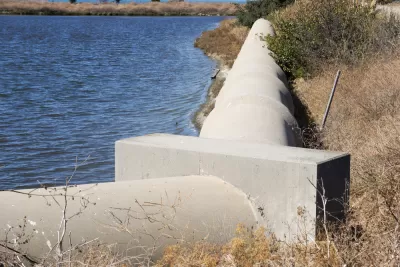
The nine counties and 101 municipalities that span the water in the San Fransisco Bay Area have two common issues: the threat of sea-level rise and the lack of a regional plan to address rising sea levels. "Sea-level rise already threatens the bay shore, which, at about 500 miles, is half the length of the entire California coast. The worst is yet to come: The Bay Area needs to plan for a 2-foot rise by 2050 and up to 7 feet by 2100," warns Robin Meadows.
Foster City, a community with a population of 34,000 people became the first municipality to build a levee large enough to protect the city's shoreline in 2018. Great for the City of Foster City, but what about their neighbors? As Meadows explains, "When seawalls are taller in one part of the bay, water can surge over lower walls in a completely different part."
Jessica Fain is the planner hoping to change the situation and unite municipalities under a cohesive plan. Even if her agency comes up with what they consider to be the ideal plan, they have no authority to implement. Without local coordination, the least wealthy cities and communities could be submerged by 2030. Fain hopes to give each community a voice and all stakeholders a say in the planning process.
FULL STORY: Bay Area towns need to address sea-level rise. Will they?


Lower Manhattan Climate Resilience Plan Released
The Financial District and Seaport Climate Resilience Master Plan will extend the shoreline in Lower Manhattan by up to 200 feet.
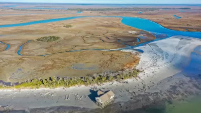
An Open Space Plan for Cultural Landscapes, Resilience, and Growth in the Coastal Southeast
The Beaufort County Greenprint Plan, completed in 2020, offers an innovative model of open space planning integrated within a larger planning framework.
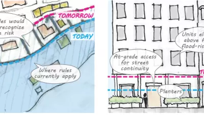
Proposed Citywide Rezoning Would Layer Resilience in New York City
With 520 miles of coastline, New York City is ready to implement the lessons of Hurricane Sandy in the zoning code for the entire city.

Alabama: Trump Terminates Settlements for Black Communities Harmed By Raw Sewage
Trump deemed the landmark civil rights agreement “illegal DEI and environmental justice policy.”

Planetizen Federal Action Tracker
A weekly monitor of how Trump’s orders and actions are impacting planners and planning in America.

The 120 Year Old Tiny Home Villages That Sheltered San Francisco’s Earthquake Refugees
More than a century ago, San Francisco mobilized to house thousands of residents displaced by the 1906 earthquake. Could their strategy offer a model for the present?

Ken Jennings Launches Transit Web Series
The Jeopardy champ wants you to ride public transit.

BLM To Rescind Public Lands Rule
The change will downgrade conservation, once again putting federal land at risk for mining and other extractive uses.

Indy Neighborhood Group Builds Temporary Multi-Use Path
Community members, aided in part by funding from the city, repurposed a vehicle lane to create a protected bike and pedestrian path for the summer season.
Urban Design for Planners 1: Software Tools
This six-course series explores essential urban design concepts using open source software and equips planners with the tools they need to participate fully in the urban design process.
Planning for Universal Design
Learn the tools for implementing Universal Design in planning regulations.
Clanton & Associates, Inc.
Jessamine County Fiscal Court
Institute for Housing and Urban Development Studies (IHS)
City of Grandview
Harvard GSD Executive Education
Toledo-Lucas County Plan Commissions
Salt Lake City
NYU Wagner Graduate School of Public Service