


Trends in land use and development are made obvious with satellite imagery tracking changes during the 2010s.
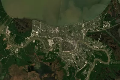
Emily Badger and Quoctrung Bui of The New York Times, worked with Tim Wallace and Krishna Karra from Descartes Labs, a geospatial analytics company to track trends in development over the past decade.
"With [satellite imagery's] growing power and precision, we can see both intimate details — a single home, bulldozed; a tennis court, reinvented — and big patterns that recur across the country," write Badger and Bui.
The trends they spot from above are illustrated in the source article, but they read as follows:
- The Exurbs Boom Again
- The Urban Core, Redeveloped
- Diversity Becomes the Norm
- Big Tech's Imprint
- Big Tech's Big Boxes
- Rust Belt Homes, Demolished
- Transit Transformations
- After Disaster, Renewal
FULL STORY: A Decade of Urban Transformation, Seen From Above


Planning for Proximity, for the Climate’s Sake
A new global platform will help the world identify and encourage opportunities for more proximity in the built environment—development patterns that can help reduce sources of greenhouse gas emissions and other forms of pollution if built well.

Snohomish County, Washington, Sets its Sights on Sprawl
Advocates say it’s unnecessary, but Snohomish County is preparing to expand its urban growth areas to allow for more low density residential development.

Planning for Congestion Relief
The third and final installment of Planetizen's examination of the role of the planning profession in both perpetuating and solving traffic congestion.

Alabama: Trump Terminates Settlements for Black Communities Harmed By Raw Sewage
Trump deemed the landmark civil rights agreement “illegal DEI and environmental justice policy.”

Study: Maui’s Plan to Convert Vacation Rentals to Long-Term Housing Could Cause Nearly $1 Billion Economic Loss
The plan would reduce visitor accommodation by 25% resulting in 1,900 jobs lost.

Planetizen Federal Action Tracker
A weekly monitor of how Trump’s orders and actions are impacting planners and planning in America.

Wind Energy on the Rise Despite Federal Policy Reversal
The Trump administration is revoking federal support for renewable energy, but demand for new projects continues unabated.

Passengers Flock to Caltrain After Electrification
The new electric trains are running faster and more reliably, leading to strong ridership growth on the Bay Area rail system.

Texas Churches Rally Behind ‘Yes in God’s Back Yard’ Legislation
Religious leaders want the state to reduce zoning regulations to streamline leasing church-owned land to housing developers.
Urban Design for Planners 1: Software Tools
This six-course series explores essential urban design concepts using open source software and equips planners with the tools they need to participate fully in the urban design process.
Planning for Universal Design
Learn the tools for implementing Universal Design in planning regulations.
Caltrans
Smith Gee Studio
Institute for Housing and Urban Development Studies (IHS)
City of Grandview
Harvard GSD Executive Education
Toledo-Lucas County Plan Commissions
Salt Lake City
NYU Wagner Graduate School of Public Service