


A call for cities like New York to accurately map, model, and share information on underground water and utility infrastructure for public benefit.
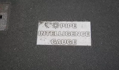
Alan Leidner writes about the need to daylight information about the underground infrastructure that makes New York City work—not the subways, "the tangle of gas, electric, water and steam lines on which the city depends."
Leidner, president of the Geospatial Information Systems and Mapping Organization and former director of Citywide GIS at the New York City Department of Information Technology and Telecommunications, is an expert on the subject.
Unfortunately, there is no combined data set showing location and condition of all utility infrastructure. Lack of awareness drives up the cost of capital infrastructure projects. (In the case of Super Storm Sandy in 2012, for instance, New York City could have reduced its $19 billion repair bill if only it had better data capture, sharing and analysis.) Lack of awareness prolongs emergency recovery. And, in the worst cases, it proves fatal when volatile components trigger catastrophe such as a water main break causing a gas main explosion.
Leidner's argument is that the technology exists to link geographic information system (GIS) data to building information modeling (BIM) to create a sophisticated and powerful map of the city's underground systems. That information can then be used for "risk analysis of storms, floods, earthquakes or other disasters," and to "help detect single points of failure, triggers for cascading events, vulnerabilities and interdependencies."
Leidner points to the city of Auckland, in Australia, as an example of a connected model of underground infrastructure, along with Flanders, London, Helsinki, Zurich, Melbourne, Singapore, and Hong Kong.
Moreover, according to Leidner: "The Open Geospatial Consortium (OGC), the data standards organization of the GIS community, has been working over the past three years to develop a data model that allows information from all utilities to be combined and analyzed."
FULL STORY: City's underground infrastructure needs to be mapped and shared


Using Machine Learning to Optimize Utility Management
Discover how machine learning optimizes city utility management for enhanced efficiency and reduced operational costs.
Building Resiliency in Rural Power Grids
A National Science Foundation study seeks to understand the impact of climate change and extreme weather on rural electrical grids in diverse geographic areas.

Utilities Spending Less on Energy Efficiency Despite Higher Fuel Prices
A survey of major utilities reveals a link between states with strict efficiency standards and incentive programs and efforts to improve efficiency on the part of utilities.

Alabama: Trump Terminates Settlements for Black Communities Harmed By Raw Sewage
Trump deemed the landmark civil rights agreement “illegal DEI and environmental justice policy.”

Planetizen Federal Action Tracker
A weekly monitor of how Trump’s orders and actions are impacting planners and planning in America.

The 120 Year Old Tiny Home Villages That Sheltered San Francisco’s Earthquake Refugees
More than a century ago, San Francisco mobilized to house thousands of residents displaced by the 1906 earthquake. Could their strategy offer a model for the present?

In Both Crashes and Crime, Public Transportation is Far Safer than Driving
Contrary to popular assumptions, public transportation has far lower crash and crime rates than automobile travel. For safer communities, improve and encourage transit travel.

Report: Zoning Reforms Should Complement Nashville’s Ambitious Transit Plan
Without reform, restrictive zoning codes will limit the impact of the city’s planned transit expansion and could exclude some of the residents who depend on transit the most.

Judge Orders Release of Frozen IRA, IIJA Funding
The decision is a victory for environmental groups who charged that freezing funds for critical infrastructure and disaster response programs caused “real and irreparable harm” to communities.
Urban Design for Planners 1: Software Tools
This six-course series explores essential urban design concepts using open source software and equips planners with the tools they need to participate fully in the urban design process.
Planning for Universal Design
Learn the tools for implementing Universal Design in planning regulations.
Clanton & Associates, Inc.
Jessamine County Fiscal Court
Institute for Housing and Urban Development Studies (IHS)
City of Grandview
Harvard GSD Executive Education
Toledo-Lucas County Plan Commissions
Salt Lake City
NYU Wagner Graduate School of Public Service