


Hurricane Dorian wreaked havoc on the Bahamas for several days before turning toward the Southeastern United States.
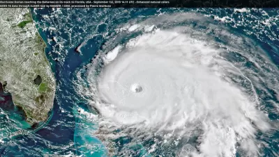
A short article by Meg Wagner and Artemis Moshtaghian features a slider image showing a before and after picture of Grand Bahama island. Hurricane Dorian left much of the island is underwater.
These satellite images show Grand Bahama before and after Hurricane Dorian's wrath https://t.co/VumnBGWnZw pic.twitter.com/4wDsAMbagE
— CNN (@CNN) September 3, 2019
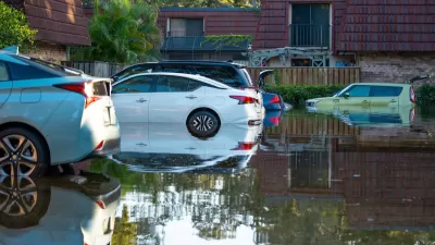
In a separate article, Brian Resnick also provides more in-depth coverage and initial images of the destruction. The complete scope of the destruction is still unknown, but the estimates are distressing. Bahamas Prime Minister Hubert Minnis is quoted in the article summing up the situation bluntly: "We are in the midst of a historic tragedy."
The article includes additional images from the Bahamas to illustrate the scope of the destruction. Images include aerial photos of decimated neighborhoods as well as dispatches from the human activity of recovery in the aftermath of the storm.
FULL STORY: Hurricane Dorian photos: what the aftermath of a Category 5 storm looks like

Auto Insurance Rates Spike Due to Extreme Weather
Car insurance costs around the country are going up as insurers receive more claims from areas struck by storms and other climate disasters.
Rising Insurance Rates Squeezing Affordable Housing Developers
Spiking insurance costs in coastal areas prone to climate disasters are making it harder for low-income housing developers to keep building.
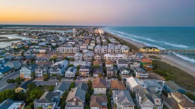
Will Hurricanes Drive Away Florida’s Retirees?
Some children of Florida retirees are urging their parents to leave hurricane-prone areas for safer regions.

Alabama: Trump Terminates Settlements for Black Communities Harmed By Raw Sewage
Trump deemed the landmark civil rights agreement “illegal DEI and environmental justice policy.”

Planetizen Federal Action Tracker
A weekly monitor of how Trump’s orders and actions are impacting planners and planning in America.

The 120 Year Old Tiny Home Villages That Sheltered San Francisco’s Earthquake Refugees
More than a century ago, San Francisco mobilized to house thousands of residents displaced by the 1906 earthquake. Could their strategy offer a model for the present?

Ken Jennings Launches Transit Web Series
The Jeopardy champ wants you to ride public transit.

BLM To Rescind Public Lands Rule
The change will downgrade conservation, once again putting federal land at risk for mining and other extractive uses.

Indy Neighborhood Group Builds Temporary Multi-Use Path
Community members, aided in part by funding from the city, repurposed a vehicle lane to create a protected bike and pedestrian path for the summer season.
Urban Design for Planners 1: Software Tools
This six-course series explores essential urban design concepts using open source software and equips planners with the tools they need to participate fully in the urban design process.
Planning for Universal Design
Learn the tools for implementing Universal Design in planning regulations.
Clanton & Associates, Inc.
Jessamine County Fiscal Court
Institute for Housing and Urban Development Studies (IHS)
City of Grandview
Harvard GSD Executive Education
Toledo-Lucas County Plan Commissions
Salt Lake City
NYU Wagner Graduate School of Public Service