


The Marchetti Constant, the willingness of people to travel for about a half an hour to get to and from work, explains the size of cities in history, and the metropolitan areas of today.
Jonathan English explains the Marchetti Constant:
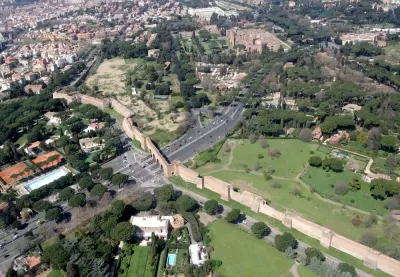
In 1994, Cesare Marchetti, an Italian physicist, described an idea that has come to be known as the Marchetti Constant [pdf]. In general, he declared, people have always been willing to commute for about a half-hour, one way, from their homes each day.
This principle has profound implications for urban life. The value of land is governed by its accessibility—which is to say, by the reasonable speed of transport to reach it.
English also takes a tour of urban history for examples of how the Marchetti Constant has played out, and how cities have changed as transportation technology has changed and enabled longer commutes. The pattern has repeated, writes English, over and over again, from Ancient Rome to Paris to London to Chicago and, finally, Atlanta.
FULL STORY: The Commuting Principle That Shaped Urban History

Reports of 'Mega-Commutes' Greatly Exaggerated
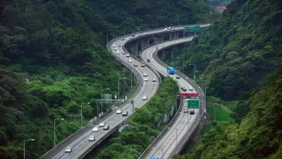
No one is denying that many Americans endure long, arduous commutes. But the data does not verify reports that "mega-commutes" are on the rise.
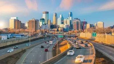
Twin Cities Commutes Faster Than Pre-Pandemic
Workers who have returned to in-person jobs are still experiencing less traffic congestion than in 2019.
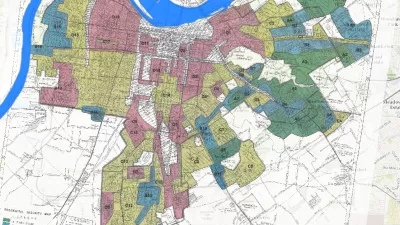
Story Mapping the Racism in Planning History
A Story Map created by the Louisville Metro Office of Planning & Design Services offers a detailed, visual presentation of the history of racism and discriminatory in the planning and zoning of the Louisville and Jefferson County.

Alabama: Trump Terminates Settlements for Black Communities Harmed By Raw Sewage
Trump deemed the landmark civil rights agreement “illegal DEI and environmental justice policy.”

Planetizen Federal Action Tracker
A weekly monitor of how Trump’s orders and actions are impacting planners and planning in America.

The 120 Year Old Tiny Home Villages That Sheltered San Francisco’s Earthquake Refugees
More than a century ago, San Francisco mobilized to house thousands of residents displaced by the 1906 earthquake. Could their strategy offer a model for the present?

Ken Jennings Launches Transit Web Series
The Jeopardy champ wants you to ride public transit.

BLM To Rescind Public Lands Rule
The change will downgrade conservation, once again putting federal land at risk for mining and other extractive uses.

Indy Neighborhood Group Builds Temporary Multi-Use Path
Community members, aided in part by funding from the city, repurposed a vehicle lane to create a protected bike and pedestrian path for the summer season.
Urban Design for Planners 1: Software Tools
This six-course series explores essential urban design concepts using open source software and equips planners with the tools they need to participate fully in the urban design process.
Planning for Universal Design
Learn the tools for implementing Universal Design in planning regulations.
Clanton & Associates, Inc.
Jessamine County Fiscal Court
Institute for Housing and Urban Development Studies (IHS)
City of Grandview
Harvard GSD Executive Education
Toledo-Lucas County Plan Commissions
Salt Lake City
NYU Wagner Graduate School of Public Service