


Cities across the country are developing floodplain construction standards that are more stringent than those required by FEMA.

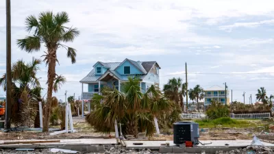
James Bruggers reports that a number of cities are trying to get ahead of the threat of flooding by putting building standards in place that exceed federal ones. "Hundreds of communities and as many as 22 states already require new construction be elevated higher than federal requirements in the high-risk 100-year floodplain, which is based on a 1 percent chance of flooding in any given year."
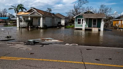
Some local municipalities, however, are going even further by applying the standards to buildings in the 500-year floodplain, where flood insurance is voluntary. For example, Mexico Beach, Florida, found that new FEMA flood maps will move 40 homes in the 100-year floodplain to the 500-year floodplain, even though half the homes were destroyed by Hurricane Michael last year. The city passed an ordinance requiring that new construction in both floodplains be elevated at least a foot and a half above FEMA flood predictions, writes Bruggers.
Baltimore, Cedar Falls, and Charlotte and Mecklenburg County in North Carolina have taken similar preemptive measures. After Houston’s experience with Hurricane Harvey, the city started requiring that new development be two feet above expected flood levels, says Bruggers:
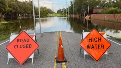
The remnants of Hurricane Harvey dumped roughly 50 inches of rain on parts of Houston over four days in August 2017, flooding more than 150,000 homes in that city alone, according to a city study. That study concluded that if all of Houston's homes had been compliant with the city's new rules, 84 percent of the city's homes that flooded during Harvey would have been spared.
Experts say that FEMA flood maps are not accurately assessing risk and that many maps are outdated. FEMA, however, argues that the maps are used for insurance purposes only, and it says it encourages cities to set their own higher standards.
FULL STORY: Not Trusting FEMA’s Flood Maps, More Storm-Ravaged Cities Set Tougher Rules

FEMA Flood Insurance Updates Reflect Actual Risk to Each Home
Changes to how FEMA calculates flood risk will assess risk at a home-by-home level, rather than estimating the same risk to all homes in the same floodplain.
FEMA Suspends Flood Rebuilding Standard
The rule was designed to prevent the rebuilding of government-funded projects in areas prone to repeated floods.
Floodplain Development Largely Concentrated in Gulf Coast States
Many U.S. cities use ‘routine’ practices like zoning changes and permitting to discourage development in high-risk flood zones.

Alabama: Trump Terminates Settlements for Black Communities Harmed By Raw Sewage
Trump deemed the landmark civil rights agreement “illegal DEI and environmental justice policy.”

Planetizen Federal Action Tracker
A weekly monitor of how Trump’s orders and actions are impacting planners and planning in America.

Why Should We Subsidize Public Transportation?
Many public transit agencies face financial stress due to rising costs, declining fare revenue, and declining subsidies. Transit advocates must provide a strong business case for increasing public transit funding.

Judge Orders Release of Frozen IRA, IIJA Funding
The decision is a victory for environmental groups who charged that freezing funds for critical infrastructure and disaster response programs caused “real and irreparable harm” to communities.

‘Clybourne Park’ Sets Stage for Housing Equity Discussions
Clybourne Park, a play exploring race, real estate, and community tensions, can set the stage for discussion on the lasting impacts of housing discrimination, gentrification, and the fight for affordability.

Understanding Road Diets
An explainer from Momentum highlights the advantages of reducing vehicle lanes in favor of more bike, transit, and pedestrian infrastructure.
Urban Design for Planners 1: Software Tools
This six-course series explores essential urban design concepts using open source software and equips planners with the tools they need to participate fully in the urban design process.
Planning for Universal Design
Learn the tools for implementing Universal Design in planning regulations.
Caltrans
Smith Gee Studio
Institute for Housing and Urban Development Studies (IHS)
City of Grandview
Harvard GSD Executive Education
Toledo-Lucas County Plan Commissions
Salt Lake City
NYU Wagner Graduate School of Public Service