


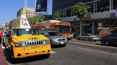
Conventional planning evaluates transport system performance car-centric indicators such as roadway Level-of-Service (LOS). Many jurisdictions are shifting to Vehicle Miles Traveled (VMT), which supports multimodal planning and Smart Growth policies.

[Update: Since we published this article, the video has been removed from YouTube.]
LOS stands for Level of Service, an outdated, discredited, highly car-centric way of measuring how streets work. Historically California law required LOS studies to evaluate environmental impacts. VMT stands for Vehicle Miles Traveled, a newer better way of measuring how streets and projects work.
The shift from LOS to VMT is one of the most important changes that affect vehicle travel, development patterns, health, air quality, and much more. California and Seattle are just two jurisdictions that are shifting to using VMT to evaluate transport system performance. This shift is, unfortunately, a wonky issue, difficult for many people to understand and support.
This new video by Fehr and Peers explains VMT in a fun and accessible way.
FULL STORY: An Introduction to VMT

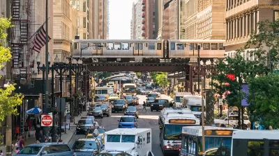
Level of Service Canceled in Los Angeles
The Los Angeles City Council voted to officially end the use of Level of Service in measuring environmental impact in favor of a more people-friendly measure: vehicle miles traveled.
Planning for Congestion Relief
The third and final installment of Planetizen's examination of the role of the planning profession in both perpetuating and solving traffic congestion.
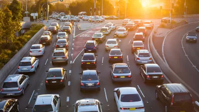
How Planning Fails to Solve Congestion
Solutions for congestion are never as simple and easy as armchair planners and engineers would like you to believe—especially those who suggest that congestion can be solved by forever building more roadway capacity.

Alabama: Trump Terminates Settlements for Black Communities Harmed By Raw Sewage
Trump deemed the landmark civil rights agreement “illegal DEI and environmental justice policy.”

Planetizen Federal Action Tracker
A weekly monitor of how Trump’s orders and actions are impacting planners and planning in America.

The 120 Year Old Tiny Home Villages That Sheltered San Francisco’s Earthquake Refugees
More than a century ago, San Francisco mobilized to house thousands of residents displaced by the 1906 earthquake. Could their strategy offer a model for the present?

Ken Jennings Launches Transit Web Series
The Jeopardy champ wants you to ride public transit.

BLM To Rescind Public Lands Rule
The change will downgrade conservation, once again putting federal land at risk for mining and other extractive uses.

Indy Neighborhood Group Builds Temporary Multi-Use Path
Community members, aided in part by funding from the city, repurposed a vehicle lane to create a protected bike and pedestrian path for the summer season.
Urban Design for Planners 1: Software Tools
This six-course series explores essential urban design concepts using open source software and equips planners with the tools they need to participate fully in the urban design process.
Planning for Universal Design
Learn the tools for implementing Universal Design in planning regulations.
Clanton & Associates, Inc.
Jessamine County Fiscal Court
Institute for Housing and Urban Development Studies (IHS)
City of Grandview
Harvard GSD Executive Education
Toledo-Lucas County Plan Commissions
Salt Lake City
NYU Wagner Graduate School of Public Service