


With limited action at the state level, communities in vulnerable areas have launched their own local preparedness programs and plans.
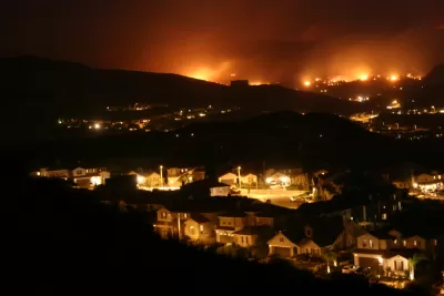
Doug Smith and Ben Welsh report on a Los Angeles Times analysis of buildings located in hazardous wildfire areas in California. "More than 1.1 million structures, or roughly 1 in 10 buildings in California, lie within the highest-risk fire zones in maps drawn by the Department of Forestry and Fire Protection, the analysis showed."
The highest concentration of these structures is in Los Angeles, where 114,000 homes, industrial buildings, and other buildings are located in high-risk areas. San Diego follows with 88,000 buildings. Areas where cities butt up against rocky terrain are the most vulnerable, note Smith and Welsh.
"Although they identify areas where stricter building standards and brush clearance are required, the maps do not directly trigger land-use restrictions or funds to make communities less vulnerable," say Smith and Welsh. The state mandates building codes, but retrofitting existing buildings and disaster preparedness remain largely the responsibility of local jurisdictions and fire departments.
Some communities in Southern California have taken the initiative to prepare for wildfires, where residents and local governments have organized volunteer arson watch and emergency response teams, conducted fire risk assessments, and held public meetings about safety and evacuation plans. However, many of these efforts still remain largely untested, since these are areas that were minimally affected by recent wildfires.
FULL STORY: A million California buildings face wildfire risk. ‘Extraordinary steps’ are needed to protect them

Resilient Communities, Healthy Ecosystems: A Balanced Approach to Wildfires
Effective wildfire mitigation in California requires a holistic approach that goes beyond large-scale vegetation removal, emphasizing home hardening, defensible space, strategic planning, and reducing human-caused ignitions.
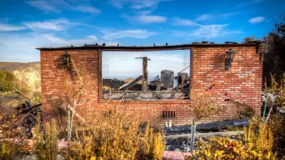
California Faces Costly Measures in Preparing for Future Wildfires
In California, recovery after wildfires means many upfront investments by communities and the state.

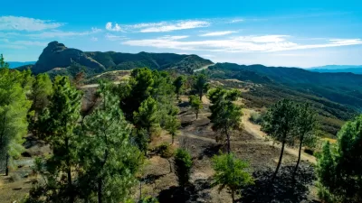
Wildfire Risks Make Southern California Development a Gamble
The Tejon Ranch development would bring thousands of homes to a highly fire-prone area in L.A. County.

Alabama: Trump Terminates Settlements for Black Communities Harmed By Raw Sewage
Trump deemed the landmark civil rights agreement “illegal DEI and environmental justice policy.”

Planetizen Federal Action Tracker
A weekly monitor of how Trump’s orders and actions are impacting planners and planning in America.

The 120 Year Old Tiny Home Villages That Sheltered San Francisco’s Earthquake Refugees
More than a century ago, San Francisco mobilized to house thousands of residents displaced by the 1906 earthquake. Could their strategy offer a model for the present?

Ken Jennings Launches Transit Web Series
The Jeopardy champ wants you to ride public transit.

BLM To Rescind Public Lands Rule
The change will downgrade conservation, once again putting federal land at risk for mining and other extractive uses.

Indy Neighborhood Group Builds Temporary Multi-Use Path
Community members, aided in part by funding from the city, repurposed a vehicle lane to create a protected bike and pedestrian path for the summer season.
Urban Design for Planners 1: Software Tools
This six-course series explores essential urban design concepts using open source software and equips planners with the tools they need to participate fully in the urban design process.
Planning for Universal Design
Learn the tools for implementing Universal Design in planning regulations.
Clanton & Associates, Inc.
Jessamine County Fiscal Court
Institute for Housing and Urban Development Studies (IHS)
City of Grandview
Harvard GSD Executive Education
Toledo-Lucas County Plan Commissions
Salt Lake City
NYU Wagner Graduate School of Public Service