


An intrepid mapmaker has created a stunning map of the Pacific Electric Railway System, the old public transit system for L.A. and surrounding environs, once the largest trolley system in the world.

Erick Galindo shares the work of Jake Berman, who recently posted a map of the historic Los Angeles streetcar network on Reddit. Berman is quoted directly in the article explaining the thinking behind the map:
"I’d like Angelenos to be able to imagine a Los Angeles that wasn’t totally dependent on the car," Berman told L.A. Taco. "Contrary to popular belief, it was the streetcars that originally defined L.A. and you can still see traces of that legacy across the metropolis if you know where to look."
Berman has created a lot more maps, if visualizing a publicly oriented version of Los Angeles isn't enough. Berman's map work on his site fifty-three studio includes historical maps of Caracas, Venezuela and Oakland as well as the light rail system in Wakanda from Black Panther.
FULL STORY: THE GLORY DAYS OF L.A. PUBLIC TRANSIT IN 1926, MAPPED


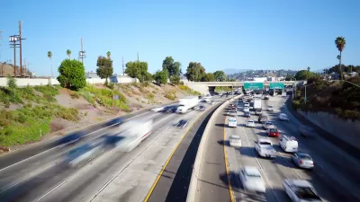
UCLA Will Build California’s First EV Charging Roadway
The ¾-mile segment will allow electric shuttles and buses to charge while driving.

LA’s ‘Car-Free’ Olympic Dream Is in Danger
Can the city fund its ambitious plans to build over $3 billion of public transit and sustainable transportation projects before the 2028 Olympic Games?
Opinion: LA Should Reject ‘Misguided’ Car-Centric Policies
Even as the city highlights clean energy and transportation for the 2028 Olympics, Metro and Caltrans move forward with plans to expand highways.

Alabama: Trump Terminates Settlements for Black Communities Harmed By Raw Sewage
Trump deemed the landmark civil rights agreement “illegal DEI and environmental justice policy.”

Planetizen Federal Action Tracker
A weekly monitor of how Trump’s orders and actions are impacting planners and planning in America.

The 120 Year Old Tiny Home Villages That Sheltered San Francisco’s Earthquake Refugees
More than a century ago, San Francisco mobilized to house thousands of residents displaced by the 1906 earthquake. Could their strategy offer a model for the present?

In Both Crashes and Crime, Public Transportation is Far Safer than Driving
Contrary to popular assumptions, public transportation has far lower crash and crime rates than automobile travel. For safer communities, improve and encourage transit travel.

Report: Zoning Reforms Should Complement Nashville’s Ambitious Transit Plan
Without reform, restrictive zoning codes will limit the impact of the city’s planned transit expansion and could exclude some of the residents who depend on transit the most.

Judge Orders Release of Frozen IRA, IIJA Funding
The decision is a victory for environmental groups who charged that freezing funds for critical infrastructure and disaster response programs caused “real and irreparable harm” to communities.
Urban Design for Planners 1: Software Tools
This six-course series explores essential urban design concepts using open source software and equips planners with the tools they need to participate fully in the urban design process.
Planning for Universal Design
Learn the tools for implementing Universal Design in planning regulations.
Clanton & Associates, Inc.
Jessamine County Fiscal Court
Institute for Housing and Urban Development Studies (IHS)
City of Grandview
Harvard GSD Executive Education
Toledo-Lucas County Plan Commissions
Salt Lake City
NYU Wagner Graduate School of Public Service