


A German research team used AI to understand how thermal stress will impact urban infrastructure down to the street level.
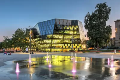
A project from the University of Freiburg in Germany assessed how researchers can use artificial intelligence to model the impacts of climate change and calculate ‘thermal stress’ on local infrastructure down to the street level.
According to an article on Phys.org, the model estimates how heat and thermal stress will impact facilities. “In a simulation as well as on the basis of interviews with representatives from various departments of Freiburg's city administration, the researchers also studied where the project's AI-based tools could actually be put to good use in urban planning, what opportunities, risks, and challenges this would involve, and how the tools should be further adapted for practical use.”
The article adds, “The model still needs to be merged with data on the vulnerability of individual urban spaces, but it can already be used now to evaluate urban planning measures such as the unsealing of surfaces. In addition, the researchers developed a novel method for automatically determining where to plant trees in a neighborhood to achieve the maximum reduction of thermal stress.”
FULL STORY: How cities can use AI to adapt to climate change

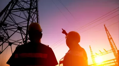
Federal and State Responses to Extreme Heat
Governments are mobilizing resources to address the impacts of longer and more intense heat waves on public health and infrastructure.
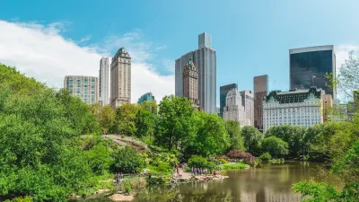
Public Parks as Climate Resilience Tools
Designed with green infrastructure, parks can mitigate flooding, reduce urban heat, and enhance climate resilience, offering cost-effective solutions to environmental challenges while benefiting communities.

Planning Trends for 2025: Creative Housing Solutions, Ongoing Transit Woes, and the Ever-Creeping Tentacles of AI
Urban planners have no shortage of urgent issues to delve into, from a deepening housing crisis to an increasingly unpredictable climate to a new federal administration bent on slashing key funding for everything from electric cars to housing assistance.

Alabama: Trump Terminates Settlements for Black Communities Harmed By Raw Sewage
Trump deemed the landmark civil rights agreement “illegal DEI and environmental justice policy.”

Planetizen Federal Action Tracker
A weekly monitor of how Trump’s orders and actions are impacting planners and planning in America.

The 120 Year Old Tiny Home Villages That Sheltered San Francisco’s Earthquake Refugees
More than a century ago, San Francisco mobilized to house thousands of residents displaced by the 1906 earthquake. Could their strategy offer a model for the present?

Ken Jennings Launches Transit Web Series
The Jeopardy champ wants you to ride public transit.

BLM To Rescind Public Lands Rule
The change will downgrade conservation, once again putting federal land at risk for mining and other extractive uses.

Indy Neighborhood Group Builds Temporary Multi-Use Path
Community members, aided in part by funding from the city, repurposed a vehicle lane to create a protected bike and pedestrian path for the summer season.
Urban Design for Planners 1: Software Tools
This six-course series explores essential urban design concepts using open source software and equips planners with the tools they need to participate fully in the urban design process.
Planning for Universal Design
Learn the tools for implementing Universal Design in planning regulations.
Clanton & Associates, Inc.
Jessamine County Fiscal Court
Institute for Housing and Urban Development Studies (IHS)
City of Grandview
Harvard GSD Executive Education
Toledo-Lucas County Plan Commissions
Salt Lake City
NYU Wagner Graduate School of Public Service