


Learn how Maui County is integrating sea level rise and coastal threats into planning for and protecting its 65 beach parks.
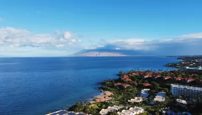
Maui is perhaps best known as a popular tourist destination. After all, the Hawaiian island is beloved for its world-famous beaches, the sacred ʻĪao Valley, views of humpback whales, farm-to-table cuisine, and the magnificent sunrise and sunset from Haleakalā. However, Maui is also facing some challenges related to climate change.
In this article, Maui County Department of Parks and Recreation (DPR) planners David Yamashita and Jen Maydan discuss an important project initiated in 2020 to assess the vulnerability of beach parks and facilities to flooding and land loss due to sea level rise and other threats and to identify adaptation strategies to address these threats. Completed with the assistance of Tetra Tech, Inc., the project consists of four phases: (1) identify the vulnerability rating for each park; (2) prepare six general strategies; (3) develop an interactive web-based app; and (4) prepare more detailed recommendations for parks that are particularly vulnerable to coastal threats in the short term.
The analysis generated a wealth of information about park vulnerability and adaptation responses, which varied by district. Most parks, about 60 percent, have a medium adaptation potential, while 20 percent have a high potential, and 20 percent have a low potential. Of the six adaptation strategies, “maintain facilities and monitor conditions” was recommended for 30 percent of the 65 parks. “Assess park viability based on future access” was the second most recommended strategy, which indicates that park access roads also are vulnerable to shoreline hazards. A key takeaway is that sea-level rise is a problem that affects the DPR and state and county departments, all of which will need to coordinate and collaborate.
For more information, please read the source article.
FULL STORY: Climate Change Is Now


SoCal Leaders Debate Moving Coastal Rail Line
Train tracks running along the Pacific Ocean are in danger from sea level rise, but residents are divided on how to fix the problem.
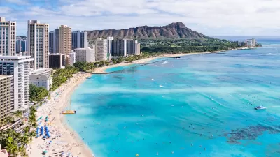
Rising Above: Innovative Solutions for Waikīkī’s Sea-Level Challenges
The University of Hawaiʻi at Mānoa’s award-winning Waikīkī sea-level rise adaptation project combines science, architecture, and community input to create scalable solutions for climate resilience and coastal flood mitigation.
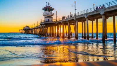
Storms and Sea Levels: The Growing Threat to California’s Piers
California’s aging piers face growing threats from climate change, with intensifying storms, rising repair costs, and structural vulnerabilities forcing tough decisions about their future preservation.

Alabama: Trump Terminates Settlements for Black Communities Harmed By Raw Sewage
Trump deemed the landmark civil rights agreement “illegal DEI and environmental justice policy.”

Planetizen Federal Action Tracker
A weekly monitor of how Trump’s orders and actions are impacting planners and planning in America.

The 120 Year Old Tiny Home Villages That Sheltered San Francisco’s Earthquake Refugees
More than a century ago, San Francisco mobilized to house thousands of residents displaced by the 1906 earthquake. Could their strategy offer a model for the present?

In Both Crashes and Crime, Public Transportation is Far Safer than Driving
Contrary to popular assumptions, public transportation has far lower crash and crime rates than automobile travel. For safer communities, improve and encourage transit travel.

Report: Zoning Reforms Should Complement Nashville’s Ambitious Transit Plan
Without reform, restrictive zoning codes will limit the impact of the city’s planned transit expansion and could exclude some of the residents who depend on transit the most.

Judge Orders Release of Frozen IRA, IIJA Funding
The decision is a victory for environmental groups who charged that freezing funds for critical infrastructure and disaster response programs caused “real and irreparable harm” to communities.
Urban Design for Planners 1: Software Tools
This six-course series explores essential urban design concepts using open source software and equips planners with the tools they need to participate fully in the urban design process.
Planning for Universal Design
Learn the tools for implementing Universal Design in planning regulations.
Clanton & Associates, Inc.
Jessamine County Fiscal Court
Institute for Housing and Urban Development Studies (IHS)
City of Grandview
Harvard GSD Executive Education
Toledo-Lucas County Plan Commissions
Salt Lake City
NYU Wagner Graduate School of Public Service