


A new tool uses aerial image recognition to map a city’s sidewalks and crosswalks. Its developers hope it will aid in creating a more comprehensive understanding of pedestrian networks and where improvements are needed.
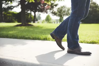
For many Americans, walking is an essential part of their daily trips to transit stops, schools, jobs, and other destinations. But as Peter Disikes explains for the MIT News Office, “Most cities and towns in the U.S. do not have sidewalk maps, and pedestrians are usually left to fend for themselves.”
Thanks to an effort led by researchers from MIT and other universities, “an open-source tool that uses aerial imagery and image-recognition to create complete maps of sidewalks and crosswalks” is now helping to bridge the information gap and provide planners and policymakers with a way to accurately assess the state of their city’s sidewalk network. “The tool, called TILE2NET, has been developed using a few U.S. areas as initial sources of data, but it can be refined and adapted for use anywhere.”
While many cities have incomplete sidewalk systems, advocating for expanding them is difficult without access to hard data. “The whole world of urban data for public transit and pedestrians and bicycles is really far behind [vehicle data] in quality. Analyzing how cities can be operational without a car requires this kind of data,” says Andres Sevtsuk, associate professor at MIT.
FULL STORY: Where the sidewalk ends

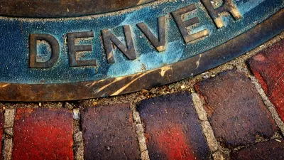
Denver Takes on Sidewalk Repair
The Colorado capital is the largest U.S. city to commit to maintaining its entire sidewalk network, funding repairs through a fee on property owners.

Chicago Allocates $500K to Sidewalk Clearing Pilot
Advocates of the Plow the Sidewalks program were asking for $1 million to start a pilot program in four areas of the city.
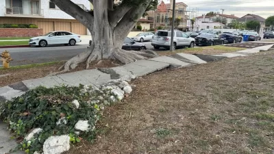
The City of Broken Sidewalks
Can Los Angeles fix 4,000 miles of broken sidewalks before the city hosts the 2028 Olympic Games?

Study: Maui’s Plan to Convert Vacation Rentals to Long-Term Housing Could Cause Nearly $1 Billion Economic Loss
The plan would reduce visitor accommodation by 25,% resulting in 1,900 jobs lost.

North Texas Transit Leaders Tout Benefits of TOD for Growing Region
At a summit focused on transit-oriented development, policymakers discussed how North Texas’ expanded light rail system can serve as a tool for economic growth.

Using Old Oil and Gas Wells for Green Energy Storage
Penn State researchers have found that repurposing abandoned oil and gas wells for geothermal-assisted compressed-air energy storage can boost efficiency, reduce environmental risks, and support clean energy and job transitions.

Private Donations Propel Early Restoration of Palisades Playground
Los Angeles has secured over $1.3 million in private funding to restore the Pacific Palisades playground months ahead of schedule, creating a modern, accessible space that supports community healing after recent wildfires.

From Blight to Benefit: Early Results From California’s Equitable Cleanup Program
The Equitable Community Revitalization Grant (ECRG) program is reshaping brownfield redevelopment by prioritizing projects in low-income and environmental justice communities, emphasizing equity, transparency, and community benefits.

Planting Relief: Tackling Las Vegas Heat One Tree at a Time
Nevada Plants, a Las Vegas-based nonprofit, is combating the city’s extreme urban heat by giving away trees to residents in underserved neighborhoods, promoting shade, sustainability, and community health.
Urban Design for Planners 1: Software Tools
This six-course series explores essential urban design concepts using open source software and equips planners with the tools they need to participate fully in the urban design process.
Planning for Universal Design
Learn the tools for implementing Universal Design in planning regulations.
Ascent Environmental
Borough of Carlisle
Institute for Housing and Urban Development Studies (IHS)
City of Grandview
Harvard GSD Executive Education
Toledo-Lucas County Plan Commissions
Salt Lake City
NYU Wagner Graduate School of Public Service