


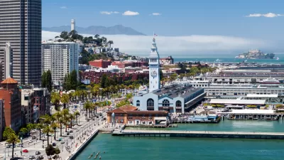
A massive climate adaptation planning effort is underway for the docks (and seawalls and landfill) of the San Francisco Bay.
The Port of San Francisco and the U.S. Army Corps of Engineers is undertaking a multi-year effort to study and plan for sea-level rise in San Francisco, where the city's bay shoreline is expected to rise as much as seven feet.
John King reports on the study for the San Francisco Chronicle, including details on the scope of the plan, which plans on a 100-year timeline for 7.5 miles of the shoreline, from Fisherman’s Wharf south to the Hunters Point shipyard. The study is a component of the Port of San Francisco's Waterfront Resilience Program.
"A tentative outline of any plan and its potential costs won’t emerge before next spring. But some ideas that are in the mix — including locks on Mission Creek, and letting industrial land near the southern waterfront revert to natural conditions — hint at how profoundly the city’s relationship to the bay could change in coming decades," according to King.
"To draw up a potential plan, seven different response scenarios must be sorted through by the Army Corps and a half dozen city agencies. The final product would seek to protect inland resources while maintaining or improving public access to the bay," adds King.
As noted in the article, the Port of San Francisco is already working to reinforce the city's shoreline from rising bay waters, with the Embarcadero Seawall Program—another component of the Waterfront Resilience Program.
FULL STORY: S.F.’s plan to protect the city from sea-level rise will ‘set the stage for our future shoreline’

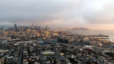
Report: Embarcadero Needs to Rise 7 Feet to Resist Sea-Level Rise
A bombshell report details the adaptation measures that will be necessary to keep San Francisco's Embarcadero high and dry as the climate changes and sea levels rise.
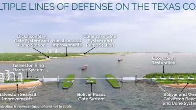
$31 Billion ‘Ike Dike’ Hurricane Protection Project Moving Through Congress
Congress authorized the $31 billion ‘Ike Dike’ sea-level rise adaptation project, along with a laundry list of other water infrastructure projects.
Where the Ground Sinks Under the Weight of Development
New research documents how the weight of buildings causes the ground to sink underneath developments in the San Francisco Bay Area.

Trump Administration Could Effectively End Housing Voucher Program
Federal officials are eyeing major cuts to the Section 8 program that helps millions of low-income households pay rent.

Planetizen Federal Action Tracker
A weekly monitor of how Trump’s orders and actions are impacting planners and planning in America.

Ken Jennings Launches Transit Web Series
The Jeopardy champ wants you to ride public transit.

Crime Continues to Drop on Philly, San Francisco Transit Systems
SEPTA and BART both saw significant declines in violent crime in the first quarter of 2025.

How South LA Green Spaces Power Community Health and Hope
Green spaces like South L.A. Wetlands Park are helping South Los Angeles residents promote healthy lifestyles, build community, and advocate for improvements that reflect local needs in historically underserved neighborhoods.

Sacramento Plans ‘Quick-Build’ Road Safety Projects
The city wants to accelerate small-scale safety improvements that use low-cost equipment to make an impact at dangerous intersections.
Urban Design for Planners 1: Software Tools
This six-course series explores essential urban design concepts using open source software and equips planners with the tools they need to participate fully in the urban design process.
Planning for Universal Design
Learn the tools for implementing Universal Design in planning regulations.
Heyer Gruel & Associates PA
Ada County Highway District
Institute for Housing and Urban Development Studies (IHS)
City of Grandview
Harvard GSD Executive Education
Toledo-Lucas County Plan Commissions
Salt Lake City
NYU Wagner Graduate School of Public Service