


When complete, the newly named DFW Discovery Trail will incorporate 50 miles of existing trails into a regional ‘super highway.’
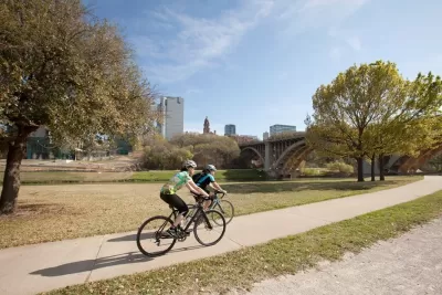
Dallas residents have voted on the name of a new, 66-mile long biking and walking trail that will connect Dallas and the surrounding communities of Arlington, Irving and Grand Prairie. According to local officials, the DFW Discovery Trail will “promote healthy living, reduce traffic congestion and draw tourism for events like races,” writes Sarah Bahari in the Dallas Morning News.
To date, around 50 miles of the trail are open to the public. “Once complete, DFW Discovery Trail will connect existing smaller trails, including the Trinity Skyline Trail in Dallas, Fort Worth Trinity Trails, Campion Trail in Irving and River Legacy Trail in Arlington.”
The North Central Texas Council of Governments (NCTCOG) website describes the agreement to build the trail, stating, “The trail was highlighted as a resource and asset to their communities from an economic development perspective and tourism aspect, as well as the benefits to health and reduction of congestion that alternative transportation routes can offer.”
FULL STORY: Long-planned D-FW ‘super highway’ trail finally gets a name

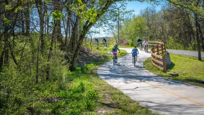
Repositioning Bike and Walking Trails as Essential Infrastructure
Cities and states can access federal transportation funding by including trails in long-range transportation plans.
Trees Beautify Segment of Atlanta’s BeltLine
A local nonprofit planted 500 trees along a previously unimpressive segment of the bike and walking trail, creating an ‘instant forest’ effect.
Detroit Opens Segment of Joe Lewis Greenway
The newly opened segment, which features playground equipment and public lawns, is part of a 27.5 mile greenway that will loop through four cities.

Alabama: Trump Terminates Settlements for Black Communities Harmed By Raw Sewage
Trump deemed the landmark civil rights agreement “illegal DEI and environmental justice policy.”

Planetizen Federal Action Tracker
A weekly monitor of how Trump’s orders and actions are impacting planners and planning in America.

Why Should We Subsidize Public Transportation?
Many public transit agencies face financial stress due to rising costs, declining fare revenue, and declining subsidies. Transit advocates must provide a strong business case for increasing public transit funding.

Blinded by the Light: When Brighter Headlights Decrease Safety
Bright LED headlights can create glare and reduce visibility for other drivers and pedestrians.

Study Links Covid and Poor Driving
The effects of the virus, including ‘brain fog,’ can make driving more difficult and dangerous.

Waymo Gets Permission to Map SF’s Market Street
If allowed to operate on the traffic-restricted street, Waymo’s autonomous taxis would have a leg up over ride-hailing competitors — and counter the city’s efforts to grow bike and pedestrian on the thoroughfare.
Urban Design for Planners 1: Software Tools
This six-course series explores essential urban design concepts using open source software and equips planners with the tools they need to participate fully in the urban design process.
Planning for Universal Design
Learn the tools for implementing Universal Design in planning regulations.
Caltrans
Smith Gee Studio
Institute for Housing and Urban Development Studies (IHS)
City of Grandview
Harvard GSD Executive Education
Toledo-Lucas County Plan Commissions
Salt Lake City
NYU Wagner Graduate School of Public Service