


The McHarg Center's "The 2100 Project: An Atlas for the Green New Deal" provides a series of maps an infographics to illustrate the way the United States uses land.
Iman Gosh shares a set of maps recently published by the McHarg Center that puts U.S. land use in perspective.
"The '2100 Project: An Atlas for the Green New Deal' provides a snapshot of U.S. land use (as of 2017), aimed at managing resources to support this future," explains Gosh. Here's how the maps break down the country's land use by type:
- Forests (27%)
- Shrubland (24%)
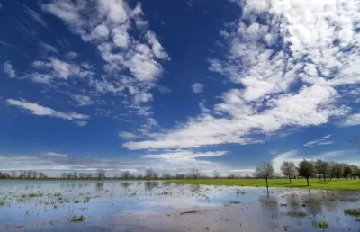
- Agriculture (17%)
- Grasslands and Pasture (17%)
- Wetlands (5%)
- Other (3%)
- Urban Areas (2%)
A few of Gosh's takeaways from the map include the outsized influence of urban areas, the vast footprint of forests, and some specifics about where the country grows its food.
"The U.S. population is set to grow by 100 million more people over the coming decades, raising the pressure on limited U.S. land and natural resources. This pressure will be felt everywhere, from dense urban land to agricultural farmland," concludes Gosh, with a message about the future of land use.
FULL STORY: Mapped: The Anatomy of Land Use in America


Pop Quiz: Can You Identify Cities By Density Alone?
A Planetizen editor failed this quiz.

Mapping the LGBTQ-Friendliness of the World's Cities
A colorful data visualization tool maps information about which cities have the most protections for LGBTQ people in place. The tool is intended as a resource for LGBTQ travelers.

Poverty in the United States Explained
The Brookings Institution has provided a data-driven examination of the subject of poverty in the United States, to provide the kind of policy nuance and detail missing from the 2016 presidential campaign.

Study: Maui’s Plan to Convert Vacation Rentals to Long-Term Housing Could Cause Nearly $1 Billion Economic Loss
The plan would reduce visitor accommodation by 25,% resulting in 1,900 jobs lost.

North Texas Transit Leaders Tout Benefits of TOD for Growing Region
At a summit focused on transit-oriented development, policymakers discussed how North Texas’ expanded light rail system can serve as a tool for economic growth.

Why Should We Subsidize Public Transportation?
Many public transit agencies face financial stress due to rising costs, declining fare revenue, and declining subsidies. Transit advocates must provide a strong business case for increasing public transit funding.

How to Make US Trains Faster
Changes to boarding platforms and a switch to electric trains could improve U.S. passenger rail service without the added cost of high-speed rail.

Columbia’s Revitalized ‘Loop’ Is a Hub for Local Entrepreneurs
A focus on small businesses is helping a commercial corridor in Columbia, Missouri thrive.

Invasive Insect Threatens Minnesota’s Ash Forests
The Emerald Ash Borer is a rapidly spreading invasive pest threatening Minnesota’s ash trees, and homeowners are encouraged to plant diverse replacement species, avoid moving ash firewood, and monitor for signs of infestation.
Urban Design for Planners 1: Software Tools
This six-course series explores essential urban design concepts using open source software and equips planners with the tools they need to participate fully in the urban design process.
Planning for Universal Design
Learn the tools for implementing Universal Design in planning regulations.
Ascent Environmental
Borough of Carlisle
Institute for Housing and Urban Development Studies (IHS)
City of Grandview
Harvard GSD Executive Education
Toledo-Lucas County Plan Commissions
Salt Lake City
NYU Wagner Graduate School of Public Service