


Local news sources are shedding light on planning for a new highway route that could pass through sensitive habitat of endangered that has yet to undertake a formal environmental or public input process.
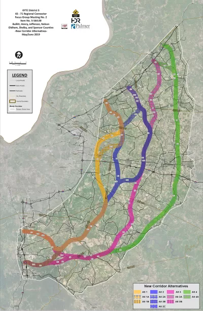
"State officials are studying plans to build a highway around Metro Louisville connecting Interstate 65 and 71, but the proposal will not include public comment or an in-depth environmental review," reports Ryan Van Velzer.
"The Kentucky Transportation Cabinet received $2 million from the legislature last year to plan a highway connecting the highways going through Bullitt and either Henry or Oldham counties" adds Van Velzer.
Plans so far include neither an environmental review nor a public input process. Advocates have already begun calling for those steps to take place earlier in the process, before the state narrows down its options for routes. Right now the state is considering 15 potential routes for the new connector.
The case for the new highway is predicated on the need to provide highway connections to growing communities in Bullitt and either Henry or Oldham counties, outside of Louisville.
Earlier coverage of the proposed connector by Marcus Green details who has been contributing feedback to the project so far, which includes "elected officials and their surrogates, local and state government agencies, chambers of commerce and industrial development organizations." As for which elected officials have been represented by the aforementioned surrogates, according to Greem they include U.S. Senate Majority Leader Mitch McConnell and Rep. John Yarmuth.
The state of Kentucky doesn't have a solid record of building necessary highway infrastructure. The Louisville-Southern Indiana Ohio River Bridges Project was strongly criticized in the planning stages and after the project opened. Aaron Renn refreshed the criticism of that project in June 2019, asking the question of whether the project was the biggest boondoggle of the 21st century.
FULL STORY: Planning For New Ky. Highway Connector Doesn’t Include Public Input (For Now)

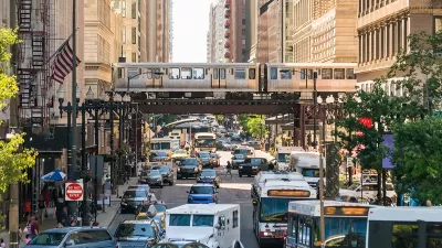
Planning for Congestion Relief
The third and final installment of Planetizen's examination of the role of the planning profession in both perpetuating and solving traffic congestion.

How Planning Fails to Solve Congestion
Solutions for congestion are never as simple and easy as armchair planners and engineers would like you to believe—especially those who suggest that congestion can be solved by forever building more roadway capacity.
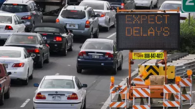
Planning and the Complicated Causes and Effects of Congestion
What do planners know about congestion, and what can they do about it? Explanations and solutions are less obvious than they seem (part one of a three-part series).

Alabama: Trump Terminates Settlements for Black Communities Harmed By Raw Sewage
Trump deemed the landmark civil rights agreement “illegal DEI and environmental justice policy.”

Planetizen Federal Action Tracker
A weekly monitor of how Trump’s orders and actions are impacting planners and planning in America.

The 120 Year Old Tiny Home Villages That Sheltered San Francisco’s Earthquake Refugees
More than a century ago, San Francisco mobilized to house thousands of residents displaced by the 1906 earthquake. Could their strategy offer a model for the present?

Ken Jennings Launches Transit Web Series
The Jeopardy champ wants you to ride public transit.

BLM To Rescind Public Lands Rule
The change will downgrade conservation, once again putting federal land at risk for mining and other extractive uses.

Indy Neighborhood Group Builds Temporary Multi-Use Path
Community members, aided in part by funding from the city, repurposed a vehicle lane to create a protected bike and pedestrian path for the summer season.
Urban Design for Planners 1: Software Tools
This six-course series explores essential urban design concepts using open source software and equips planners with the tools they need to participate fully in the urban design process.
Planning for Universal Design
Learn the tools for implementing Universal Design in planning regulations.
Clanton & Associates, Inc.
Jessamine County Fiscal Court
Institute for Housing and Urban Development Studies (IHS)
City of Grandview
Harvard GSD Executive Education
Toledo-Lucas County Plan Commissions
Salt Lake City
NYU Wagner Graduate School of Public Service