


Much of the state political leadership in Texas has been slow to accept the existence of climate change, much less the role of the state's economy, land use, and infrastructure planning in exacerbating the crisis. Maybe this will help wake them up?
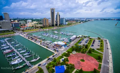
Fares Sabawi deployed Climate Central's Google Earth plug-in map to visualize the effect of sea-level rise on the Texas coast, and found bad news for Corpus Christi.
Using data from the National Oceanic and Atmospheric Agency, the Google Earth visualization shows vast portions of Corpus Christi under water at the worst-case scenario of eight feet of sea level rise by 2100.
"In Corpus Christi, much of downtown and North Beach would be submerged, according to the data. Landmarks like the Selena Memorial Statue, Heritage Park and the Texas State Aquarium would essentially be underwater," according to Sabawi.
A slideshow preceding the article, showing similarly catastrophic effects for other coastal cities in Texas, is the star of the post.
FULL STORY: Selena statue in Corpus Christi will be under water by 2100, according to water level simulator

Sea-Level Rise Would Be Worse for Coastal Cities Than Previously Thought
A new model for expected sea-level rise raises alarms about the need to adapt to sea-level rise in coastal cities all over the world.
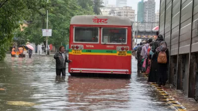
Don't Blame Climate Change for Hurricane Florence
But you can blame climate change for 6 inches of storm surge resulting from sea level rise. Florence made landfall near Wilmington, North Carolina on Friday as a Category 1 storm with wind speeds of 90 mph.

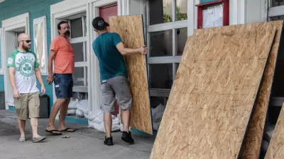
Climate Negligence in Florida?
In advance of Hurricane Irma's landfall in Florida, Governor Rick Scott worked non-stop urging residents to leave mandatory evacuation zones. But what has he done to prepare since he took office in 2011?

Trump Administration Could Effectively End Housing Voucher Program
Federal officials are eyeing major cuts to the Section 8 program that helps millions of low-income households pay rent.

Planetizen Federal Action Tracker
A weekly monitor of how Trump’s orders and actions are impacting planners and planning in America.

Ken Jennings Launches Transit Web Series
The Jeopardy champ wants you to ride public transit.

Crime Continues to Drop on Philly, San Francisco Transit Systems
SEPTA and BART both saw significant declines in violent crime in the first quarter of 2025.

How South LA Green Spaces Power Community Health and Hope
Green spaces like South L.A. Wetlands Park are helping South Los Angeles residents promote healthy lifestyles, build community, and advocate for improvements that reflect local needs in historically underserved neighborhoods.

Sacramento Plans ‘Quick-Build’ Road Safety Projects
The city wants to accelerate small-scale safety improvements that use low-cost equipment to make an impact at dangerous intersections.
Urban Design for Planners 1: Software Tools
This six-course series explores essential urban design concepts using open source software and equips planners with the tools they need to participate fully in the urban design process.
Planning for Universal Design
Learn the tools for implementing Universal Design in planning regulations.
Heyer Gruel & Associates PA
Ada County Highway District
Institute for Housing and Urban Development Studies (IHS)
City of Grandview
Harvard GSD Executive Education
Toledo-Lucas County Plan Commissions
Salt Lake City
NYU Wagner Graduate School of Public Service