


Dallas' street car lines were extensive before the age of the private car.
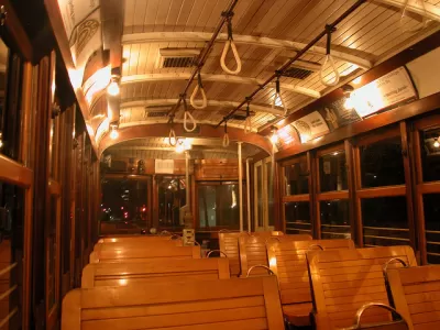
Artist Jake Berman created a map showing the extent of Dallas’s once great streetcar system. This map includes connections from the heart of the city to further out metropolises in regions like Coriscana, Waco, Denton, and Fort Worth and a network of lines traversing the city. “In fact, the new map looks like a rendering of future dreams for Dallas transit–a way to get around the inner city and plan dense development around trafficked transit corridors,” Peter Simek writes for D Magazine.
Anyone who has seen Who Framed Roger Rabbit is likely familiar with the conspiracy theories regarding the death of the streetcar. But, while car manufacturers certainly didn’t lose any sleep over the death of the streetcar, they mostly harmed it by causing the traffic that slowed it down. These slower streets, couldn’t support the then privately-owned streetcars. “By the time cities took control of the streetcars, cars had caught on and streets were crowded with traffic that slowed the lines. Service suffered. Ridership fell,” Simek writes.
“Nonetheless, looking at this revamped old map, it is difficult not to daydream about what kind of city Dallas could have been if we kept and built around the streetcar system,” Simek writes. This was Berman’s intent.
FULL STORY: Dallas Public Transit Was Better in 1919 Than It Is in 2019

Texas State Bills Could Kill Transit Funding in Dallas, Austin
State lawmakers could pull funding from the state’s largest transit agency and the ambitious Project Connect, a voter-approved transit project in Austin.

North Texas Transit Leaders Tout Benefits of TOD for Growing Region
At a summit focused on transit-oriented development, policymakers discussed how North Texas’ expanded light rail system can serve as a tool for economic growth.
Dallas Transit Officials to Meet With City Leaders in Mediation
Some cities in the Dallas area want to reduce their contributions to the regional transit system.

Alabama: Trump Terminates Settlements for Black Communities Harmed By Raw Sewage
Trump deemed the landmark civil rights agreement “illegal DEI and environmental justice policy.”

Study: Maui’s Plan to Convert Vacation Rentals to Long-Term Housing Could Cause Nearly $1 Billion Economic Loss
The plan would reduce visitor accommodation by 25% resulting in 1,900 jobs lost.

Planetizen Federal Action Tracker
A weekly monitor of how Trump’s orders and actions are impacting planners and planning in America.

Wind Energy on the Rise Despite Federal Policy Reversal
The Trump administration is revoking federal support for renewable energy, but demand for new projects continues unabated.

Passengers Flock to Caltrain After Electrification
The new electric trains are running faster and more reliably, leading to strong ridership growth on the Bay Area rail system.

Texas Churches Rally Behind ‘Yes in God’s Back Yard’ Legislation
Religious leaders want the state to reduce zoning regulations to streamline leasing church-owned land to housing developers.
Urban Design for Planners 1: Software Tools
This six-course series explores essential urban design concepts using open source software and equips planners with the tools they need to participate fully in the urban design process.
Planning for Universal Design
Learn the tools for implementing Universal Design in planning regulations.
Caltrans
Smith Gee Studio
Institute for Housing and Urban Development Studies (IHS)
City of Grandview
Harvard GSD Executive Education
Toledo-Lucas County Plan Commissions
Salt Lake City
NYU Wagner Graduate School of Public Service