


It's hard to connect zoning to planning and development outcomes at a national level because very little data exists at that scale.
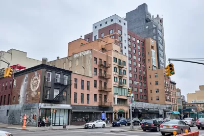
Graham MacDonald, Solomon Greene, and Emma Nechamkin put out a call for improved data on zoning to help address the nation's ongoing housing and development challenges.
Even though there has been some promising research on local zoning and land-use regulations, most has been hampered by a lack of data. How has zoning changed? What reforms were implemented and where? How have various reforms affected housing supply, affordability, and climate change? We either don’t know or know very little because data are out of date, incomplete, or do not exist.
The best existing data sources, according to the article, "consist of two surveys of local governments in the nation’s largest metropolitan areas dated 1994 and 2003, a regulatory index derived from a survey of local governments in 2007, and some recent papers that try to approximate zoning data using court decisions or construction costs (PDF)."
MacDonald, Greene, and Nechamkin are working at the Urban Institute to fill those gaps, promising to release several projects in the coming year. One fairly recent project, published in January, is already advancing the cause by assessing, "whether we can estimate density limits in local zoning codes using property assessment data."
FULL STORY: We need better zoning data to address pressing housing and development issues

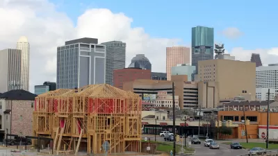
Watch: Debunking Myths About Houston's Lack of Zoning
A video published last week by City Beautiful reveals the myths and misconceptions of Houston's land use regulation system.

Zoning Didn't Stand a Chance Against the Economy in New York's Garment District
Zoning can only be so effective in holding off market forces, according to this column. New York City seems to have finally learned this lesson in the Garment District, but will it inform decisions in other parts of the city?

What Zoning Can and Can't Do
The powers, and the limitations, of zooming are explained in a series of posts on Greater Greater Washington.

Alabama: Trump Terminates Settlements for Black Communities Harmed By Raw Sewage
Trump deemed the landmark civil rights agreement “illegal DEI and environmental justice policy.”

Planetizen Federal Action Tracker
A weekly monitor of how Trump’s orders and actions are impacting planners and planning in America.

The 120 Year Old Tiny Home Villages That Sheltered San Francisco’s Earthquake Refugees
More than a century ago, San Francisco mobilized to house thousands of residents displaced by the 1906 earthquake. Could their strategy offer a model for the present?

Ken Jennings Launches Transit Web Series
The Jeopardy champ wants you to ride public transit.

BLM To Rescind Public Lands Rule
The change will downgrade conservation, once again putting federal land at risk for mining and other extractive uses.

Indy Neighborhood Group Builds Temporary Multi-Use Path
Community members, aided in part by funding from the city, repurposed a vehicle lane to create a protected bike and pedestrian path for the summer season.
Urban Design for Planners 1: Software Tools
This six-course series explores essential urban design concepts using open source software and equips planners with the tools they need to participate fully in the urban design process.
Planning for Universal Design
Learn the tools for implementing Universal Design in planning regulations.
Clanton & Associates, Inc.
Jessamine County Fiscal Court
Institute for Housing and Urban Development Studies (IHS)
City of Grandview
Harvard GSD Executive Education
Toledo-Lucas County Plan Commissions
Salt Lake City
NYU Wagner Graduate School of Public Service