


A closer look at commuting and ridership shows the differences between urban and suburban transit patterns.

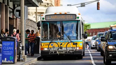
Alon Levy of the Pedestrian Observations blog compares commuter ridership on urban transit and commuter rail. He finds that in San Francisco the total number of riders on four parallel east-west Muni bus routes serving the central business district is almost twice the maximum number of commuters:
This represents an implausible 184% mode share, in a part of the city where a good number of people own and drive cars, and where some in the innermost areas could walk to work. What’s happening is that when the transit system is usable, people take it for more than just their commute trips.
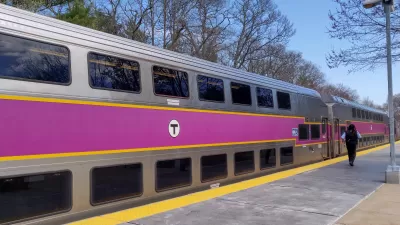
He then looks at the Massachusetts Bay Transportation Authority’s regional rail and riders coming into Boston’s CBD from suburbs and city neighborhoods near rail. Levy finds the mode share to be just 32 percent, and he notes that most commuters use other modes and very few commuter rail passengers are using rail for other non-work trips.
The difference between San Francisco and Boston is partly due to the geographic distribution of the non-work places people need to reach for shopping, errands, and services. In a city, travelers can use transit to reach these locales, but they are more likely in the suburbs to drive to them.
Levy also says that regions with transit systems that cater to commuters — trains arriving once an hour during off-peak hours, for example — will not be able to attract other types of riders. "If the station placement is designed around car travel, as is the case for all American commuter lines and some suburban rapid transit (including the tails of BART), then people will just drive all the way unless there’s peak congestion. Only very good urban transit can get this non-work ridership," he says.
FULL STORY: Urban Transit Vs. Commuter Transit


MBTA to Electrify its First Commuter Rail Line
The Massachusetts Bay Transportation Authority will electrify the 9 mile Fairmount Line, the shortest of their 12 commuter rail lines, using battery-electric multiple units. The first BEMU trains are projected to be operating in early 2028.
Boston Transit Ridership Grows Steadily
Ridership on the region’s commuter rail reached 80 percent of pre-pandemic levels in March.
Transit Plans Change as the Pandemic Lingers
The Massachusetts Bay Transportation Authority (MBTA) this week proposed cuts to public transit service. In a decision that will likely repeat as more transit agencies undertake similar processes, the MBTA decided to prioritize buses over trains.

Alabama: Trump Terminates Settlements for Black Communities Harmed By Raw Sewage
Trump deemed the landmark civil rights agreement “illegal DEI and environmental justice policy.”

Study: Maui’s Plan to Convert Vacation Rentals to Long-Term Housing Could Cause Nearly $1 Billion Economic Loss
The plan would reduce visitor accommodation by 25% resulting in 1,900 jobs lost.

Planetizen Federal Action Tracker
A weekly monitor of how Trump’s orders and actions are impacting planners and planning in America.

Waymo Gets Permission to Map SF’s Market Street
If allowed to operate on the traffic-restricted street, Waymo’s autonomous taxis would have a leg up over ride-hailing competitors — and counter the city’s efforts to grow bike and pedestrian on the thoroughfare.

Parklet Symposium Highlights the Success of Shared Spaces
Parklets got a boost during the Covid-19 pandemic, when the concept was translated to outdoor dining programs that offered restaurants a lifeline during the shutdown.

Federal Homelessness Agency Places Entire Staff on Leave
The U.S. Interagency Council on Homelessness is the only federal agency dedicated to preventing and ending homelessness.
Urban Design for Planners 1: Software Tools
This six-course series explores essential urban design concepts using open source software and equips planners with the tools they need to participate fully in the urban design process.
Planning for Universal Design
Learn the tools for implementing Universal Design in planning regulations.
Caltrans
Smith Gee Studio
Institute for Housing and Urban Development Studies (IHS)
City of Grandview
Harvard GSD Executive Education
Toledo-Lucas County Plan Commissions
Salt Lake City
NYU Wagner Graduate School of Public Service