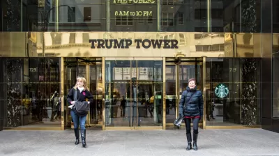
A new map shows where privately owned public spaces are located to encourage more public use.

In 1961, New York City started its program for privately owned public spaces (POPS), which gave private developers bonus floor area or waivers in exchange for providing and maintaining publicly accessible spaces on their properties. Over 550 of these POPS exist in the city today, with most located in Manhattan. However, the number of POPS in other boroughs throughout the city is increasing.
Although POPS are available for the public to use, the city has found that they are not as accessible as they should be. “While the city is home to hundreds of POPS, most people are unaware of their existence or location, and in many cases buildings were found to be in violation of the POPS laws, and restrict access to the public,” reports Tanay Warerkar.
To better inform the public, the New York City Department of City Planning has put together an interactive map of the city’s POPS. In addition to each site’s location, the map details amenities, hours of access, and information about the building. Today’s POPS are mainly public plazas and arcades, and the city hopes that more awareness of these urban spaces will lead to an increase in their use.
FULL STORY: Handy new map shows all of NYC’s privately-owned public spaces

Trump Administration Could Effectively End Housing Voucher Program
Federal officials are eyeing major cuts to the Section 8 program that helps millions of low-income households pay rent.

Planetizen Federal Action Tracker
A weekly monitor of how Trump’s orders and actions are impacting planners and planning in America.

Ken Jennings Launches Transit Web Series
The Jeopardy champ wants you to ride public transit.

Opinion: Transit Agencies Must View Service Cuts as Last Resort
Reducing service could cripple transit systems by pushing more riders to consider car ownership, making future recovery even less certain.

‘Smart Surfaces’ Policy Guide Offers Advice for Building and Maintaining Urban Tree Canopies
Healthy, robust tree canopies can reduce the impacts of extreme heat and improve air quality.

New Jersey Lawsuit Targets Rent-Setting Algorithms
The state of New Jersey is taking legal action against landlords and companies that engage in what the state’s Attorney General alleges is illegal rent fixing.
Urban Design for Planners 1: Software Tools
This six-course series explores essential urban design concepts using open source software and equips planners with the tools they need to participate fully in the urban design process.
Planning for Universal Design
Learn the tools for implementing Universal Design in planning regulations.
Heyer Gruel & Associates PA
Ada County Highway District
Institute for Housing and Urban Development Studies (IHS)
City of Grandview
Harvard GSD Executive Education
Toledo-Lucas County Plan Commissions
Salt Lake City
NYU Wagner Graduate School of Public Service


