


The New York Times publishes an interactive feature that illustrates the stubbornness of natural disasters (or humans, in the face of natural disasters).

There are places in the United States that are stuck by natural disasters over and over again.
"In the last 16 years, parts of Louisiana have been struck by six hurricanes," writes Sahil Chinoy. "Areas near San Diego were devastated by three particularly vicious wildfire seasons. And a town in eastern Kentucky has been pummeled by at least nine storms severe enough to warrant federal assistance."
The star of the show with this article is the use of maps, deployed to illustrate the scale of the conflict between humans and nature, and just where the battlefield recurs year after year. Other graphics add up the costs of all these disasters and illustrate other vital statistics, like sea level rise and number of hurricanes every year.
FULL STORY: The Places in the U.S. Where Disaster Strikes Again and Again


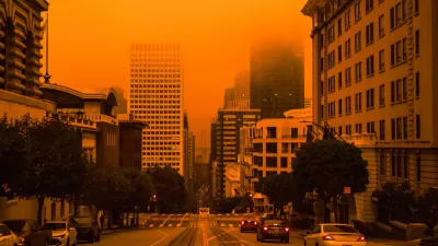
U.S. Communities Increasingly at Risk of Extreme Weather Events
As development pushes into more wildfire-prone areas and climate change makes extreme weather conditions more common, more Americans are experiencing the destructive impacts of climate disasters.
2020 Sets Record for Billion-Dollar Disasters
Tropical storms, tornadoes, and wildfires, along with everything else.

Rebuilding After Disaster: The Role of Social Connections in Resilience
Dr. Lucy Jones emphasizes that resilience in the face of climate-driven disasters like wildfires relies on building strong social connections, which empower communities to recover and adapt to an increasingly challenging future.

Alabama: Trump Terminates Settlements for Black Communities Harmed By Raw Sewage
Trump deemed the landmark civil rights agreement “illegal DEI and environmental justice policy.”

Planetizen Federal Action Tracker
A weekly monitor of how Trump’s orders and actions are impacting planners and planning in America.

The 120 Year Old Tiny Home Villages That Sheltered San Francisco’s Earthquake Refugees
More than a century ago, San Francisco mobilized to house thousands of residents displaced by the 1906 earthquake. Could their strategy offer a model for the present?

Housing Vouchers as a Key Piece of Houston’s Housing Strategy
The Houston Housing Authority supports 19,000 households through the housing voucher program.

Rural Population Grew Again in 2024
Americans continued to move to smaller towns and cities, resulting in a fourth straight year of growth in rural areas.

Safe Streets Grants: What to Know
This year’s round of Safe Streets for All grant criteria come with some changes.
Urban Design for Planners 1: Software Tools
This six-course series explores essential urban design concepts using open source software and equips planners with the tools they need to participate fully in the urban design process.
Planning for Universal Design
Learn the tools for implementing Universal Design in planning regulations.
Clanton & Associates, Inc.
Jessamine County Fiscal Court
Institute for Housing and Urban Development Studies (IHS)
City of Grandview
Harvard GSD Executive Education
Toledo-Lucas County Plan Commissions
Salt Lake City
NYU Wagner Graduate School of Public Service