


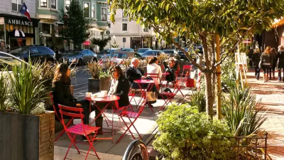
More uses and modes than ever are fighting for curb space in growing cities. Here's an app to make sense of what you can do, and when, along this valued real estate.

Andrew J. Hawkins shares news of a new tool released by Sidewalk Labs recently that makes visual sense of the way cities allow access to curb space lining busy streets.
According to Hawkins, "with the explosion of new mobility options like ride-hailing, car-sharing, and bike-sharing, and the looming specter of self-driving vehicles on the horizon, cities are starting to rethink how they allocate curb space."
Sidewalk Labs response to these changing dynamics is called Coord, a new company "focused on helping cities and mobility companies better manage traffic congestion and parking problems on their streets through a cloud-based platform."
"After digitizing the city’s curbs, including parking meters, parking signs, and curb stripes, Coord condensed all that data into a map that’s searchable by date, time, vehicle type, and desired action," adds Hawkins.
Coord released a map of San Francisco's curbsides to demonstrate the power of the idea. Hawkins outlines some use cases and previews the new mapping tool at the source article.
FULL STORY: Become a parking savant with Sidewalk Labs’ new curb visualization tool

How the Pandemic Is Reshaping Cities
The social and economic upheaval of the last two years accelerated a shift in thinking about how we use public space and organize the urban realm.

Pilot Projects Launched to Test Coordinated Curb Use
Coord, a Sidewalk Labs spinoff, has selected the winners of the inaugural Digital Curb Challenge.
Next on the List for Data Startups: Managing Curb Space
The humble curb is getting crowded: not only with new modes of transportation, but also with a slew of new data tools aiming to keep track of it all.

Alabama: Trump Terminates Settlements for Black Communities Harmed By Raw Sewage
Trump deemed the landmark civil rights agreement “illegal DEI and environmental justice policy.”

Study: Maui’s Plan to Convert Vacation Rentals to Long-Term Housing Could Cause Nearly $1 Billion Economic Loss
The plan would reduce visitor accommodation by 25% resulting in 1,900 jobs lost.

Planetizen Federal Action Tracker
A weekly monitor of how Trump’s orders and actions are impacting planners and planning in America.

Baltimore Ordered to Improve Sidewalk Accessibility
The city is one of many to face lawsuits for failing to comply with the Americans with Disabilities Act.

This Toronto Suburb Has More Bus Riders Than Columbus, Ohio
Brampton, Ontario used gradual improvements in service to prove that if you build it, they will ride.

Paris Bike Boom Leads to Steep Drop in Air Pollution
The French city’s air quality has improved dramatically in the past 20 years, coinciding with a growth in cycling.
Urban Design for Planners 1: Software Tools
This six-course series explores essential urban design concepts using open source software and equips planners with the tools they need to participate fully in the urban design process.
Planning for Universal Design
Learn the tools for implementing Universal Design in planning regulations.
Smith Gee Studio
Alamo Area Metropolitan Planning Organization
City of Santa Clarita
Institute for Housing and Urban Development Studies (IHS)
City of Grandview
Harvard GSD Executive Education
Toledo-Lucas County Plan Commissions
Salt Lake City
NYU Wagner Graduate School of Public Service