


Traffic safety still needs a lot of work. Better maps can certainly help the cause.

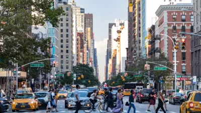
Brad Aaron describes a new and improved mapping platform by CHEKPEDS, called the Crash Mapper, as an improvement over the city's Vision Zero data mapping platform. "Crash Mapper uses the same data as the city map, but the public can do a lot more with it," writes Aaron, predicting the Crash Mapper platform will provide powerful advocacy tools in New York.
Aaron provides full details of Crash Mapper's capabilities in the source article.
FULL STORY: This Is the Tool You Need to Push for Safer Streets in Your Part of NYC

NYC Pedestrian Deaths Rose in 2024
The city’s Vision Zero efforts seem to have stalled.
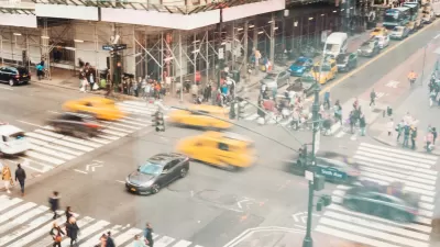
NYC Sees 127 Traffic Deaths in First Half of 2024
The number is the highest since the city pledged to end traffic deaths through Vision Zero policies a decade ago.

NYC’s Vision Zero Program Saved $90 Million in Medicaid Costs
While traffic fatalities remain far above zero, the city saw fewer injuries compared to areas without Vision Zero initiatives.

Trump Administration Could Effectively End Housing Voucher Program
Federal officials are eyeing major cuts to the Section 8 program that helps millions of low-income households pay rent.

Planetizen Federal Action Tracker
A weekly monitor of how Trump’s orders and actions are impacting planners and planning in America.

Ken Jennings Launches Transit Web Series
The Jeopardy champ wants you to ride public transit.

Tackling Soil Contamination With Nature-Based Solutions
Los Angeles County residents and experts are turning to nature-based methods like bioremediation to address long-standing and fire-exacerbated soil contamination without resorting to costly and disruptive removal.

Rebuilding Smarter: How LA County Is Guiding Fire-Ravaged Communities Toward Resilience
Los Angeles County is leading a coordinated effort to help fire-impacted communities rebuild with resilience by providing recovery resources, promoting fire-wise design, and aligning reconstruction with broader sustainability and climate goals.

When Borders Blur: Regional Collaboration in Action
As regional challenges outgrow city boundaries, “When Borders Blur” explores how cross-jurisdictional collaboration can drive smarter, more resilient urban planning, sharing real-world lessons from thriving partnerships across North America.
Urban Design for Planners 1: Software Tools
This six-course series explores essential urban design concepts using open source software and equips planners with the tools they need to participate fully in the urban design process.
Planning for Universal Design
Learn the tools for implementing Universal Design in planning regulations.
Ada County Highway District
Clanton & Associates, Inc.
Jessamine County Fiscal Court
Institute for Housing and Urban Development Studies (IHS)
City of Grandview
Harvard GSD Executive Education
Toledo-Lucas County Plan Commissions
Salt Lake City
NYU Wagner Graduate School of Public Service