


City Profiles
Explore cities through an urban planning lens.
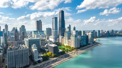
Chicago: An Urban Planner's Guide to the City
Famous for its skyscrapers, city parks, and influential planners like Daniel Burnham, the Windy City has a long urban planning legacy. But it’s got plenty of modern-day planning wins and challenges too.
Basics
- State: Illinois
- Incorporation date: March 4, 1837
- Area: 231.66 square miles
- Statehood: December 3, 1818
- Population*: 2,746,388
- Type of government: Strong mayor-council
- Planning department website: Chicago Department of Planning and Development
- Comprehensive plan: We Will Chicago (City), Go to 2040 (Regional)
*Current as of 2020 Census.
Chicago's indigenous history
The area of present-day Chicagoland lies on the Western coast of Lake Michigan. Thanks to the region’s plentiful resources and abundant game and plant life, it served as homeland to several Indigenous groups at various times, including the Council of Three Fires (the Potawatomi, the Ojibwe, and the Odawa), the Menominee, the Ho-Chunk, Miami, Sak, Fox, Kickapoo, and Illinois tribes and nations. Because of Chicago’s position at the mouth of a major tributary, it also served as a key crossroads for tribal nations to gather for trade and cooperation agreements.
Today, there is no federally recognized tribal land in Illinois, but Chicago is home to the largest population (22,000) of Indigenous Americans in the Midwest, the second largest population east of the Mississippi River, and the oldest “urban Indian” center in the country. The American Indian Center was founded to offer social services in 1953 and is currently located in the Albany Park neighborhood. The area’s Indigenous history is evident across the city in its place and street names: Chicago River, Michigan Avenue, Milwaukee Avenue, Ottawa Avenue, Washtenaw Avenue, Winnemac Avenue. Some roadways, including diagonal thoroughfares Lincoln Avenue and Clark Street, echo the tribes’ trade roads.
Colonization, the Great Fire, and the Colombian Exposition
The French first encountered the Illinois tribe in the region in the 1670s and established strong ties with Indigenous communities, particularly through trade. Many traders, such as Jean Baptiste Point du Sable who settled at the mouth of the Chicago River, married native women and had children in the late 1700s. In 1803, the United States built Fort Dearborn on the south side of the Chicago River, and led to the development of several settlements around the area and thriving trade and cultural relations between natives, Europeans, and Americans living there. Then came the French and Indian War of 1812, pitting the French against the Americans and the British; the local Indigenous groups fought on both sides of the war, straining their relationship with each other and the British and U.S. governments.
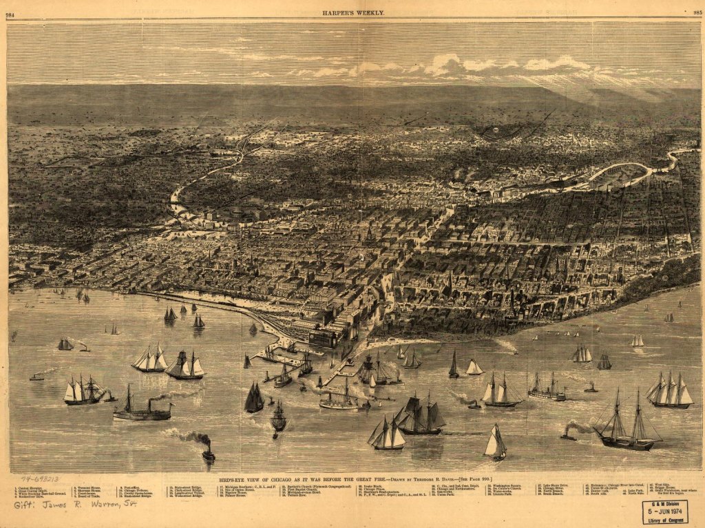
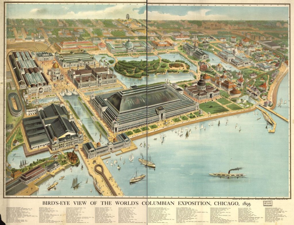
In 1830 President Andrew Jackson signed the Indian Removal Act, which relocated Indigenous tribes, including those in the Chicago area, west of the Mississippi River. The city of Chicago was incorporated in 1837, and the Illinois & Michigan Canal linking the Great Lakes and the Mississippi River was completed in 1848. The infamous Great Fire of 1871 razed most of the city, which was built from wood, to the ground, the debris of which was dumped into Lake Michigan, building up the land where Grant Park, Millennium Park, and the Art Institute of Chicago now stand. Chicago rebuilt quickly, this time in steel, including the nation’s first skyscraper in 1884. By 1893, the city hosted the Columbian Exposition, which included the famous “White City.”
20th century growth: Industry, segregation, and transit
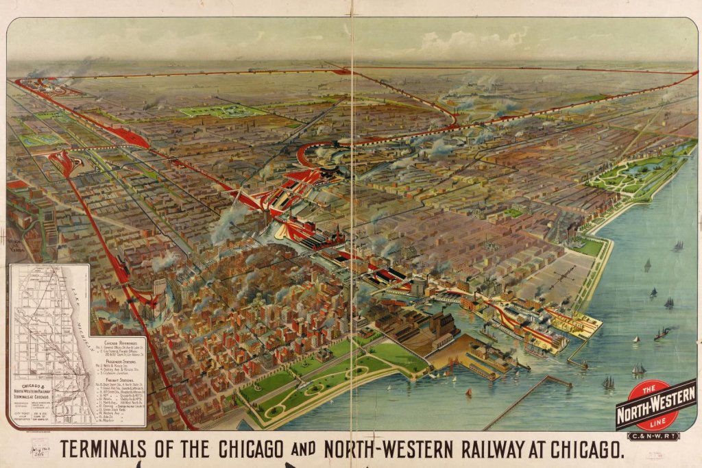
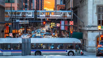
Chicago experienced massive growth and change in the 20th century. In 1900, the Chicago Sanitary and Ship Canal opened to traffic, linking the Mississippi watershed and Lake Michigan, which expanded shipping routes and reversed the flow of the Chicago River. The city soon became the world’s largest rail hub and one of its busiest shipping ports. Today, 50 percent of U.S. rail freight continues to pass through Chicago and O’Hare and Midway International airports have led to the city becoming the nation’s busiest aviation center.
Chicago’s population exploded in the late 19th and early 20th centuries, largely from an influx of European immigrants to staff the city’s manufacturing factories and meatpacking plants and then steady stream of African Americans from the rural South during the Great Migration (1910-1970). In 1890, just before the turn of the century, Chicago became the third U.S. city to reach 1 million residents (after New York and Philadelphia), from just 100,000 in 1860. At the end of World War I, Chicago’s population had swelled to 2.7 million. The city’s population peaked at 3.6 million in 1950 and declined to about 2.8 million at the end of the century, where it has remained relatively steady.
It was also during this time that Chicago underwent significant racial diversification and the city’s stark racial segregation patterns developed. In 1900, the city was 98 percent white. That changed drastically as between 1918 (the end of WWI) and 2000, the White population fell to 32 percent, and the Black and Latino populations swelled from 3 to 37 percent and >1 to 26 percent of the city’s population, respectively. In 1910, all but four of Chicago’s neighborhoods were more than 90 percent white; at the turn of the millennium, the city’s South and West Sides were majority Black, while four neighborhoods on the North side were majority Latino and another four had shifted from majority white to having no majority demographic.
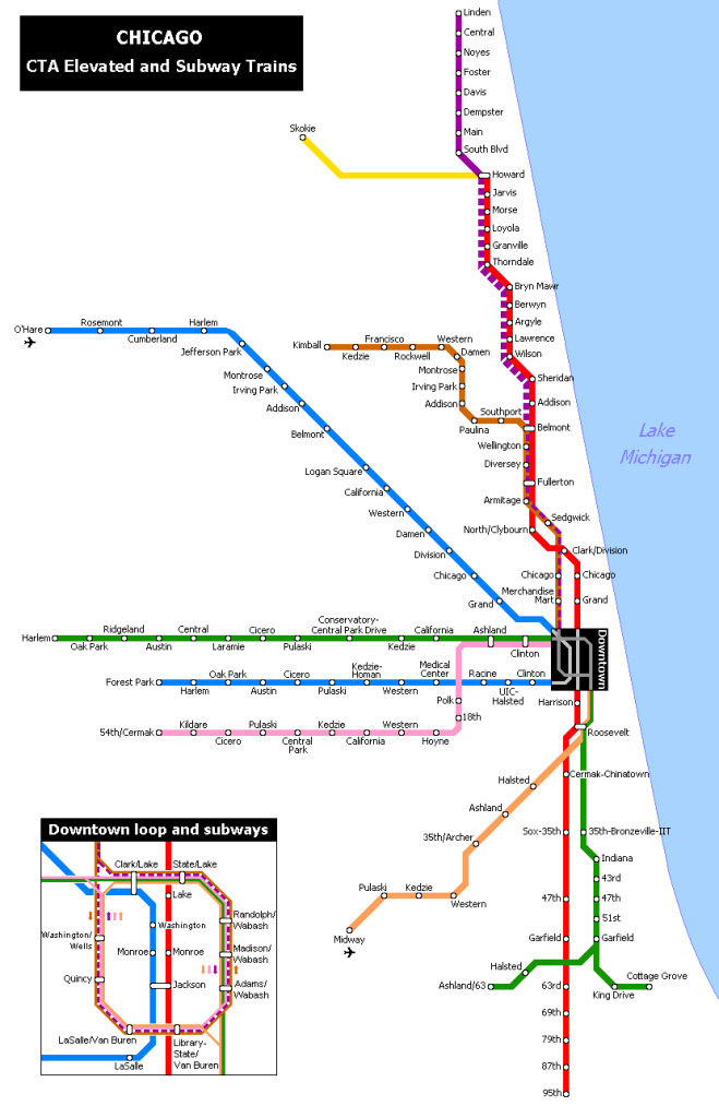
Development exploded starting in the 1920s, though it was temporarily dampened by the Depression, including a number of famous works of architecture, including skyscrapers, buildings, bridges, and more. It was also during this century that the Chicago Transit Authority was formed, though the construction of the modern-day elevated rail network began in the late 1900s and developed throughout the 20th century.
21st century concerns: Pandemic recovery for downtown and public transit
Chicago has been slow to recover since the Covid-19 pandemic. Because of decreased visitors and commuters and an increase in remote or hybrid work, the downtown district is struggling from high commercial building vacancy rates, which — combined with high interest rates — created a commercial real estate crisis. In an effort to combat this, in 2024, Chicago launched a program to convert several high-rise buildings in Chicago’s business district into housing.
Public transit ridership has also lagged behind pre-pandemic levels, driven by falling rider confidence in reliability because of service cutbacks, as well as staffing issues. Without federal pandemic funding to make up revenue differences, as of spring 2024, the city’s regional public transportation network faced a $730 million budget shortfall.
Like many cities across the nation, housing affordability is a major concern for the Chicago metropolitan area, as high interest rates and low inventory drive home prices and rents higher and higher in all neighborhoods. As one of the most segregated cities in the United States, Chicago has long struggled with issues of social and environmental equity and justice. These issues were exacerbated during the Covid-19 pandemic, which disproportionately impacted BIPOC communities. Gentrification and displacement are also major threats to residents of Chicago’s historically Black and Latino communities on the South, West, and North sides.
Key planning milestones in Chicago
- 1779: Jean Baptiste Pointe du Sable builds the first permanent, non-indigenous settlement in what is now Chicago.
- 1833: The Town of Chicago is incorporated with a population of less than 200.
- 1836: An early map drawn by canal commissioners designates the land that is now Grant Park as public land.
- 1848: The Illinois & Michigan Canal, linking the Great Lakes and the Mississippi River, opens.
- 1848: Chicago’s first railroad tracks are laid, paving the way for the city to become the railroad hub of the nation.
- 1893: Chicago hosts the World’s Columbian Exposition, for which architect Daniel Burnham served as chief designer and supervisor of construction, and which marked the start of the City Beautiful movement.
- 1897: The Union Elevated Railroad constructs the elevated Loop, forming a network with several passenger rail lines already serving the city.
- 1900: The Chicago Sanitary and Ship Canal opens, reversing the flow of the Chicago River from east toward Lake Michigan to west.
- 1909: The Plan of Chicago, written by Daniel Burhham and Edward Bennett, is approved, leading to the designation of the city’s 25 miles of lakeshore as protected public parkland, and a number of other significant improvements.
- 1937: Chicago Housing Authority is established.
- 1943: Master Plan of Residential Land Use of Chicago is published by the Chicago Plan Commission, outlining issues in housing.
- 1945: Chicago Transit Authority is established.
- 1959: Chicago’s new Department of City Planning prepares the Development Plan for the Central Area of Chicago.
- 1963: O’Hare Airport opens.
- 1966: The Comprehensive Plan of Chicago is published the Chicago Plan Commission.
- 1973: The Chicago 21 city plan is published, aimed at addressing the deterioration of the central city (driven by white flight to the suburbs in the 1960s and ‘70s).
- 1984: L service to O’Hare airport starts.
- 1993: L service to Midway begins, and the lines are renamed to the colors they are today.
- 2000: The U.S. Department of Housing and Urban Development approves the Chicago Housing Authority Plan for Transformation.
- 2004: Millennium Park opens after 12 years of instruction.
- 2005: The Chicago Metropolitan Planning Agency was established as the state-authorized regional planning agency and federally designated metropolitan planning organization, covering a seven-county area.
- 2006: Pink line of the L opens.
- 2016: Chicago Riverwalk is completed, seven years after first segment opened.
- 2022: Chicago publishes We Will Chicago city plan, more than 50 years since the last one.

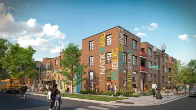
Museum of Public Housing Opens in Chicago
The museum highlights the history of public housing in the United States using displays intimately woven with family artifacts.
Chicago Transit Agencies on Brink of Major Crisis
Without additional funding, regional transit agencies will be forced to cut services by 40 percent.

Study: Most Chicago Rideshare Trips Could Be Made by Transit
Researchers found that 99 percent of rideshare trips could be made by buses and trains — but the time savings roughly equal an hour’s wage.
Urban Design for Planners 1: Software Tools
This six-course series explores essential urban design concepts using open source software and equips planners with the tools they need to participate fully in the urban design process.
Planning for Universal Design
Learn the tools for implementing Universal Design in planning regulations.
Heyer Gruel & Associates PA
Ada County Highway District

Institute for Housing and Urban Development Studies (IHS)
City of Grandview
Harvard GSD Executive Education
Toledo-Lucas County Plan Commissions
Salt Lake City
NYU Wagner Graduate School of Public Service