


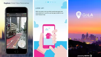
A list of mobile apps that support planning, as part of an annual update. Learn about exciting new ways to explore cities and enhance planning via mobile apps. Please feel free to add your own favorites.


Each year I provide an update on mobile applications (i.e., software designed to run on smartphones, tablet computers, and other mobile devices). Mobile applications (apps) can enhance public participation in local governance and planning as well as improve efficiency and data collection for planners.
Every year, I survey a cross-section of planners to develop a comprehensive list of the most effective mobile apps for planners. During December of 2014, I surveyed planners about their professional use of mobile apps, asking what types of mobile apps they are currently using, what apps they would like to see developed in the future, and what apps they themselves are developing.
We heard from 178 planners from across the United States. Of the planners surveyed, 96 percent own a smartphone and 1 percent plan to purchase one in the future. Planners who responded that they own a smartphone were asked about various types of apps that they might use and the frequency of their use. Results are shown in the chart below.
What types of apps do you use on a regular basis and how often do you use them?

From the survey we found similar results as to usage of apps as compared to last year. The most commonly used apps by planners in their daily lives are social media apps, like Twitter and Facebook. Note taking apps are also popular for daily use; and apps like Photoshop, PowerPoint, and Prezi, used for productivity and for presentations, are more frequently used on a monthly basis.
In the survey we also sought to understand how planners are using smartphones and mobile apps at work. Ninety-two percent of those surveyed use their smartphone for work purposes, a 10 percent increase over the previous year’s survey.
One of the primary goals of our survey was to identify apps that planners are currently using or developing to support their work. Planners mentioned common apps such as Todoist, Constant Contact, Mediafire, GoogleMaps, Dropbox, ArcGIS, GoToMeeting, and SlideShark, among others. Planners report regularly using Trulia and Zillow, which are helpful in finding information about properties. Here are a few apps planners told us about that I found to be particularly interesting.
- CamScanner: Turns mobile devices into a scanner (Android, iOS, and Windows Phone).
- Iannotate: Allows for reading, marking, and sharing documents (Android and iOS).
- Insightly: Project management, contact management, and report generation (Android and iOS).
- Instafetch: Allows for saving complete webpages for offline reading, for example: code sections, news articles, or city webpages. (Android, BlackBerry, WindowsPhone).
- Schmoose: A secure messaging platform that sends encrypted messages (Android, iOS, Windows Phone).
- SpeedGrade: A color grading app that allows for layer based color and design tools (Android and iOS).
- Textizen: Allows for sending, receiving, and analyzing text messages. Can be used for mobile surveys (all operating systems).
In the survey, planners were asked whether or not their organization has created an app or discussed creating an app. Seventeen percent responded that their organization has created an app or is int he process of creating an app. And 29 percent responded that their organization is discussing creating an app in the future. Below are five of the apps created by agencies employing planners:
- City of Calgary Downtown Public Art Circuit: Shares the location and information on artwork in downtown Calgary, Alberta (iOS).
- Kutsuplus: Seamless multi-modal transportation. This public transit service lets riders pick their pick up point and destination on a mobile device, paying through a mobile device. The app then calculates the optimal route, including a mix of transportation modes.
- The Ohio State: Includes a parking garage map showing availability of parking spaces. The Service2Facilities app allows anyone to report issues with buildings and grounds (Android and iOS).
- ParksFinder: Aids in finding nearby parks and activities—based on every federal and state park (Android and iOS).
- Seattle in Progress: Informs and engages residents about local land use and building decisions. People can click on a location and see detailed design proposals. While not an app, Seattle in Progress is mobile enabled and designed to easily be accessed on a phone.
Seattle In Progress allows people to easily see development projects

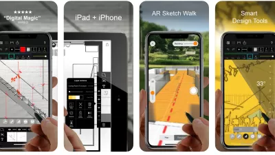
Planners would like to have more augmented reality and mapping apps that allow for easier visualization. There are a handful of augmented reality apps that are worth exploring including:
- Augment: Allows users to upload 3D images that can then be manipulated (Android and iOS).
- Theodolite: Overlays topographic information and other data, such as distance, height, and triangulation. A nice field tool for planners (Android and iOS).
- Lookator: Searches for and finds Wi-Fi networks. The user holds their mobile device up and views directions to the nearest hotspots (Android).
- Yelp Monocle: Using the mobile device’s GPS, Yelp Monocle displays "Augmented Reality" markers for nearby businesses, with user generated ratings and reviews (Android and iOS).
- SpecTrek: This game populates your surroundings with ghosts to hunt down—a fun way to explore a local park. (Android).
- Acrossair: Uses augmented reality and the video function on the iPhone to show transit lines and stations (iOS).
Theodolite allows users to understand the topography of a location using augmented reality

And of course there are many apps out there that are related to planning. These are some of the apps that I found to be interesting for planners:
- Archisketch: Set the drawing scale and then everything you sketch is to scale (iOS).
- ExitStrategyNYC: This app shows you where to stand on the subway platform to board the train and directly in front of the exit at the destination station to save time (iOS).
- I Change My City: Allows people to take pictures and report complaints in real time in Bagalore, India (Android, iOS, and Windows Phone).
- Manual: Turns a phone into a manual camera, setting focus, shutter speed, and more (iOS).
- Mind My Business: Allows small businesses to keep up with what is happening in their neighborhood, including roadway repairs and 311 neighbor complaints (iOS),
- Park Chicago: Allows users to pay for parking meters via their phone (Android and iOS),
- PostIt Plus: Captures, organizes, and shares notes (iOS),
- Shape: Allows pictures to be converted into vector shapes (iOS).
- Siga Chile: Maps accessibility of locations for those with special needs (Android and iOS).
- Simcity BuildIt: Free city building game (iOS).
- SocialCyclist: Encourages users to map route data and report road hazards and organize group rides (Android and iOS).
- Strava: This fitness tracking app used by runners and cyclists is now selling its data to local government planners. Oregon’s Department of Transportation obtained data from 20,000 bicyclists to aid in planning for the increase in bicycle traffic (Android and iOS).
- Wayper: Allows for downloading of details searchable maps of cities, to avoid data charges when on the road (iOS).
- WalkIt: Creates a route map between two points and provides information on time, calories burned, total number of steps, and carbon savings (Android and iOS).
There are certainly a lot more apps that are useful to planners. You can learn about other apps for planners by reviewing last year’s app update on Planetizen. If you have apps that should be added to our growing list for 2015, please let me know. I also regularly tweet about new apps when I come across them: @EvansCowley.
Jennifer Evans-Cowley, PhD, AICP, is the Vice Provost for Capital Planning and Regional Campuses and a Professor of City and Regional Planning at The Ohio State University.


The Best Planning Apps for 2016
A list of mobile apps that support planning, as part of an annual update. Learn about exciting new ways to explore cities and enhance planning via mobile apps. Please feel free to add your own favorites.
The Best Planning Apps for 2017
A list of mobile apps that support planning, as part of an annual update. Learn about exciting new ways to explore cities and enhance planning via mobile apps. Please feel free to add your own favorites.
Best Apps for Urban Planning in 2022
Mobile apps continue to redefine the practices of planning—urban planning, regional planning, transportation planning, community planning, and rural planning included.

Study: Maui’s Plan to Convert Vacation Rentals to Long-Term Housing Could Cause Nearly $1 Billion Economic Loss
The plan would reduce visitor accommodation by 25,% resulting in 1,900 jobs lost.

North Texas Transit Leaders Tout Benefits of TOD for Growing Region
At a summit focused on transit-oriented development, policymakers discussed how North Texas’ expanded light rail system can serve as a tool for economic growth.

Using Old Oil and Gas Wells for Green Energy Storage
Penn State researchers have found that repurposing abandoned oil and gas wells for geothermal-assisted compressed-air energy storage can boost efficiency, reduce environmental risks, and support clean energy and job transitions.

Private Donations Propel Early Restoration of Palisades Playground
Los Angeles has secured over $1.3 million in private funding to restore the Pacific Palisades playground months ahead of schedule, creating a modern, accessible space that supports community healing after recent wildfires.

From Blight to Benefit: Early Results From California’s Equitable Cleanup Program
The Equitable Community Revitalization Grant (ECRG) program is reshaping brownfield redevelopment by prioritizing projects in low-income and environmental justice communities, emphasizing equity, transparency, and community benefits.

Planting Relief: Tackling Las Vegas Heat One Tree at a Time
Nevada Plants, a Las Vegas-based nonprofit, is combating the city’s extreme urban heat by giving away trees to residents in underserved neighborhoods, promoting shade, sustainability, and community health.
Urban Design for Planners 1: Software Tools
This six-course series explores essential urban design concepts using open source software and equips planners with the tools they need to participate fully in the urban design process.
Planning for Universal Design
Learn the tools for implementing Universal Design in planning regulations.
Ascent Environmental
Borough of Carlisle
Institute for Housing and Urban Development Studies (IHS)
City of Grandview
Harvard GSD Executive Education
Toledo-Lucas County Plan Commissions
Salt Lake City
NYU Wagner Graduate School of Public Service