


The Metro Region Explorer allows the public new kinds of understanding about the city of New York and how it fits into the surrounding region.
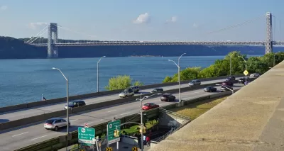
"[The New York City Department of City Planning] has launched a new mapping tool that harnesses population, housing and economic data and makes it available for exploring by the general public," reports Rachel Kaufman.
In a press release quoted by Kaufman, the city said that the Metro Region Explorer "will help New Yorkers understand the City’s relationships, including interdependencies, to areas outside our borders. It enables the public, planners and policy makers to examine the regional context for shared planning challenges. It is the only mapping resource that combines municipal population, housing and economic data across our region."
Chelsey Sanchez also reports on the capabilities of the Metro Region Explorer, noting that it grows out of the Planning Department's regional planning office, created in 2015.
FULL STORY: New York City Debuts Regional Mapping Tool


‘City of Yes’ Zoning Initiative Announced to Support Business and Housing Opportunities in NYC
New York City’s new mayor, Eric Adams, has announced a new signature zoning initiative.

New Leadership at New York Department of City Planning
With a new mayoral administration comes new planning leadership in the Big Apple.

New Interactive Mapping Tool Tracks all of NYC's Infrastructure Projects, Housing Permits, and City Facilities
The New York Department of City Planning has taken its open data practices to a new level with the launch of the Capital Planning Explorer.

Study: Maui’s Plan to Convert Vacation Rentals to Long-Term Housing Could Cause Nearly $1 Billion Economic Loss
The plan would reduce visitor accommodation by 25,% resulting in 1,900 jobs lost.

North Texas Transit Leaders Tout Benefits of TOD for Growing Region
At a summit focused on transit-oriented development, policymakers discussed how North Texas’ expanded light rail system can serve as a tool for economic growth.

Why Should We Subsidize Public Transportation?
Many public transit agencies face financial stress due to rising costs, declining fare revenue, and declining subsidies. Transit advocates must provide a strong business case for increasing public transit funding.

How to Make US Trains Faster
Changes to boarding platforms and a switch to electric trains could improve U.S. passenger rail service without the added cost of high-speed rail.

Columbia’s Revitalized ‘Loop’ Is a Hub for Local Entrepreneurs
A focus on small businesses is helping a commercial corridor in Columbia, Missouri thrive.

Invasive Insect Threatens Minnesota’s Ash Forests
The Emerald Ash Borer is a rapidly spreading invasive pest threatening Minnesota’s ash trees, and homeowners are encouraged to plant diverse replacement species, avoid moving ash firewood, and monitor for signs of infestation.
Urban Design for Planners 1: Software Tools
This six-course series explores essential urban design concepts using open source software and equips planners with the tools they need to participate fully in the urban design process.
Planning for Universal Design
Learn the tools for implementing Universal Design in planning regulations.
City of Santa Clarita
Ascent Environmental
Institute for Housing and Urban Development Studies (IHS)
City of Grandview
Harvard GSD Executive Education
Toledo-Lucas County Plan Commissions
Salt Lake City
NYU Wagner Graduate School of Public Service