


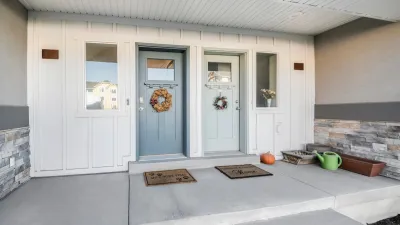
The city of Seattle provides the geography and market for a housing map that illustrates the differences between single-family and multi-family housing in terms of affordability.

Margaret Morales writes the text to accompany an ambitious new mapping project by the Sightline Institute. In the article, Morales introduces the story of a rental home comprising two units in Ballard, a neighborhood in Seattle, which was recently redeveloped into four rowhouses.
Where one home once stood, now there are 4. The homes in the new rowhouses are each, at 1,160 square feet, almost as big as the old house’s two units combined, which totaled 1,360 square feet. The rowhouses have two bedrooms and 1.5 bathrooms each. And, of course, they’re new, not a century old. They have dramatically improved insulation, wiring, plumbing, and safety features. They each sold in 2016 for more than $530,000, for a total of $2.3 million. That’s more than four and a half times the 2014 sale price of the old house, but of course, building them cost a lot, too.
Morales acknowledges that the story sounds like one of loss, and a developer getting rich while moving the city's housing stock further out of reach for most of the city's residents. But, Sightline also sees another side to the story—if the lot had been zoned for single-family zoning the blow to the city's affordability might have been worse.
To scale-up the implications of this story from Ballard, the Sightline team created a map in answer to the question: "Do multi-family homes, like the rowhouses in Devin’s story, or things like condominiums, townhomes, and the four-packs popping up across the city, offer Seattleites cheaper or more expensive housing options than single-family homes?"
The conclusion Morales gleans from the map: "Multi-family homes are offering Seattleites cheaper homeownership alternatives to single-family homes."
FULL STORY: MAP: WHERE MULTI-FAMILY HOMES MAKE SEATTLE NEIGHBORHOODS MORE AFFORDABLE


Zoning Reform: Lessons From New Zealand
The island nation is mandating mid-density zoning requirements and transit-oriented development in an effort to increase housing affordability and encourage compact development.

Survey: Seattle-Area Residents Support Upzoning
To fight the growing housing crisis, most King County residents support an end to single-family zoning and accelerated housing development, according to a new poll.
How Single-Family Conversions Benefit Both Homeowners and Cities
Converting single-family homes to triplexes can ease the housing crisis and offer affordable, flexible options for more households. Why is it largely illegal?

Study: Maui’s Plan to Convert Vacation Rentals to Long-Term Housing Could Cause Nearly $1 Billion Economic Loss
The plan would reduce visitor accommodation by 25,% resulting in 1,900 jobs lost.

North Texas Transit Leaders Tout Benefits of TOD for Growing Region
At a summit focused on transit-oriented development, policymakers discussed how North Texas’ expanded light rail system can serve as a tool for economic growth.

Why Should We Subsidize Public Transportation?
Many public transit agencies face financial stress due to rising costs, declining fare revenue, and declining subsidies. Transit advocates must provide a strong business case for increasing public transit funding.

How to Make US Trains Faster
Changes to boarding platforms and a switch to electric trains could improve U.S. passenger rail service without the added cost of high-speed rail.

Columbia’s Revitalized ‘Loop’ Is a Hub for Local Entrepreneurs
A focus on small businesses is helping a commercial corridor in Columbia, Missouri thrive.

Invasive Insect Threatens Minnesota’s Ash Forests
The Emerald Ash Borer is a rapidly spreading invasive pest threatening Minnesota’s ash trees, and homeowners are encouraged to plant diverse replacement species, avoid moving ash firewood, and monitor for signs of infestation.
Urban Design for Planners 1: Software Tools
This six-course series explores essential urban design concepts using open source software and equips planners with the tools they need to participate fully in the urban design process.
Planning for Universal Design
Learn the tools for implementing Universal Design in planning regulations.
City of Santa Clarita
Ascent Environmental
Institute for Housing and Urban Development Studies (IHS)
City of Grandview
Harvard GSD Executive Education
Toledo-Lucas County Plan Commissions
Salt Lake City
NYU Wagner Graduate School of Public Service