


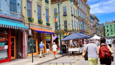
Researchers at MIT and Harvard believe that their computer vision system (i.e., artificial intelligence) helps reveal fundamental characteristics of neighborhood change.
Larry Hardesty shares news of a new "computer vision system" from MIT's Media Lab, created with partners from Harvard University, that quantifies "the physical improvement or deterioration of neighborhoods in five American cities."
In work reported today in the Proceedings of the National Academy of Sciences, the system compared 1.6 million pairs of photos taken seven years apart. The researchers used the results of those comparisons to test several hypotheses popular in the social sciences about the causes of urban revitalization. They find that density of highly educated residents, proximity to central business districts and other physically attractive neighborhoods, and the initial safety score assigned by the system all correlate strongly with improvements in physical condition.
The new tool is built on a system created four years ago, which analyzes "street-level photos taken in urban neighborhoods in order to gauge how safe the neighborhoods would appear to human observers."
Hardesty goes into a lot more detail about the ideas that contributed to the creation of the computer vision system, and the findings that have been produced in its deployment.
Linda Poon offers additional insight into the use of artificial intelligence in the analysis of urban conditions.
FULL STORY: Why do some neighborhoods improve?

Black Residents Leaving Cincinnati's Fast Growing Urban Area
The housing market in the neighborhood of Over-the-Rhine is a 'segregation machine.'
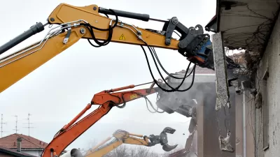
$160 Million in Bond Funding for Demolitions on the Ballot in Detroit
Proposal N, on the ballot for Detroit voters next week, will provide $160 million in bond funding for demolitions and $90 million to mothball homes for future rehab, but, according to this opinion, it won't solve the city's blight challenges.

Revitalization Without Displacement: A New Model From Miami
Upzonings in working class neighborhoods usually provoke political opposition based on concerns about gentrification and displacement. But the new Wynwood Norte Neighborhood Revitalization District in Miami might have worked for a solution.

Alabama: Trump Terminates Settlements for Black Communities Harmed By Raw Sewage
Trump deemed the landmark civil rights agreement “illegal DEI and environmental justice policy.”

Study: Maui’s Plan to Convert Vacation Rentals to Long-Term Housing Could Cause Nearly $1 Billion Economic Loss
The plan would reduce visitor accommodation by 25% resulting in 1,900 jobs lost.

Planetizen Federal Action Tracker
A weekly monitor of how Trump’s orders and actions are impacting planners and planning in America.

Wind Energy on the Rise Despite Federal Policy Reversal
The Trump administration is revoking federal support for renewable energy, but demand for new projects continues unabated.

Passengers Flock to Caltrain After Electrification
The new electric trains are running faster and more reliably, leading to strong ridership growth on the Bay Area rail system.

Texas Churches Rally Behind ‘Yes in God’s Back Yard’ Legislation
Religious leaders want the state to reduce zoning regulations to streamline leasing church-owned land to housing developers.
Urban Design for Planners 1: Software Tools
This six-course series explores essential urban design concepts using open source software and equips planners with the tools they need to participate fully in the urban design process.
Planning for Universal Design
Learn the tools for implementing Universal Design in planning regulations.
Caltrans
Smith Gee Studio
Institute for Housing and Urban Development Studies (IHS)
City of Grandview
Harvard GSD Executive Education
Toledo-Lucas County Plan Commissions
Salt Lake City
NYU Wagner Graduate School of Public Service