


The developers of San Francisco’s Transbay Transit Center say it has the potential to change travel patterns in the region and land use in the neighborhood, as did New York City’s Grand Central Terminal. How realistic is this promise?


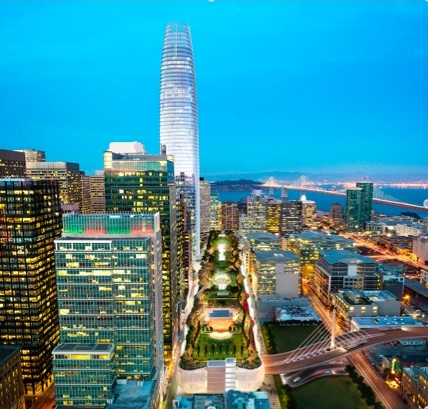
The Transbay Transit Center (TTC) in San Francisco, California is a multi-modal transit center that will link its city, region, and state's buses and electric trains, serving as the centerpiece of a new transit oriented South of Market (SOMA) neighborhood. Described as the "Grand Central Station of the West" by its development team, will the TTC transform land use in the city and transportation in the region, just as Grand Central Terminal transformed mid-town Manhattan and travel to and from New York City in the early years of the 20th century? Or is it the "billion-dollar bus station" described by critics? Grand Central's celestial ceiling links ancient travel by the stars to modern electric trains. Will the TTC influence a transition from cars and airplanes to modern electric buses and trains?
Grand Central Terminal, New York City, and the Region
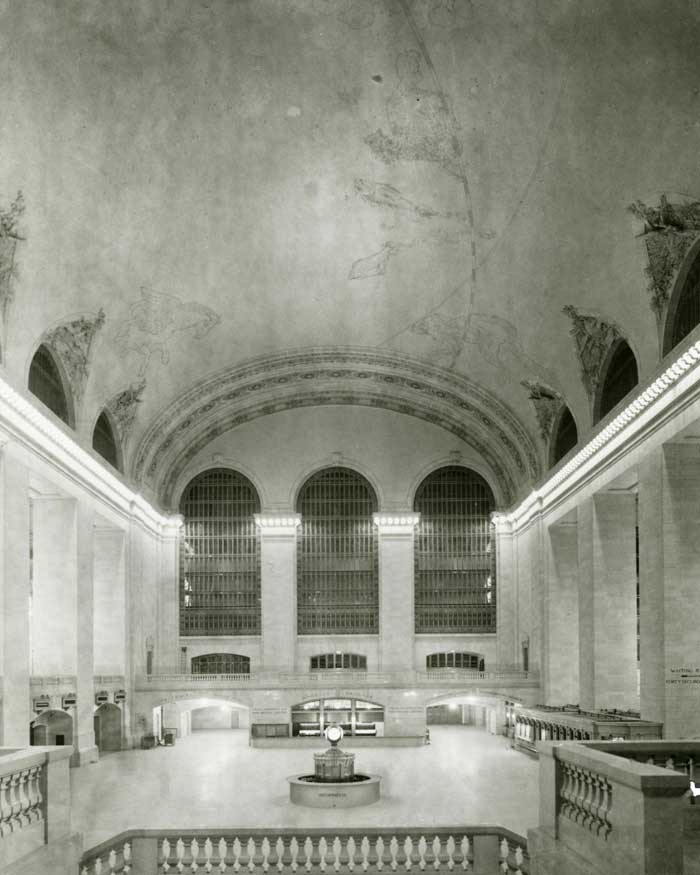
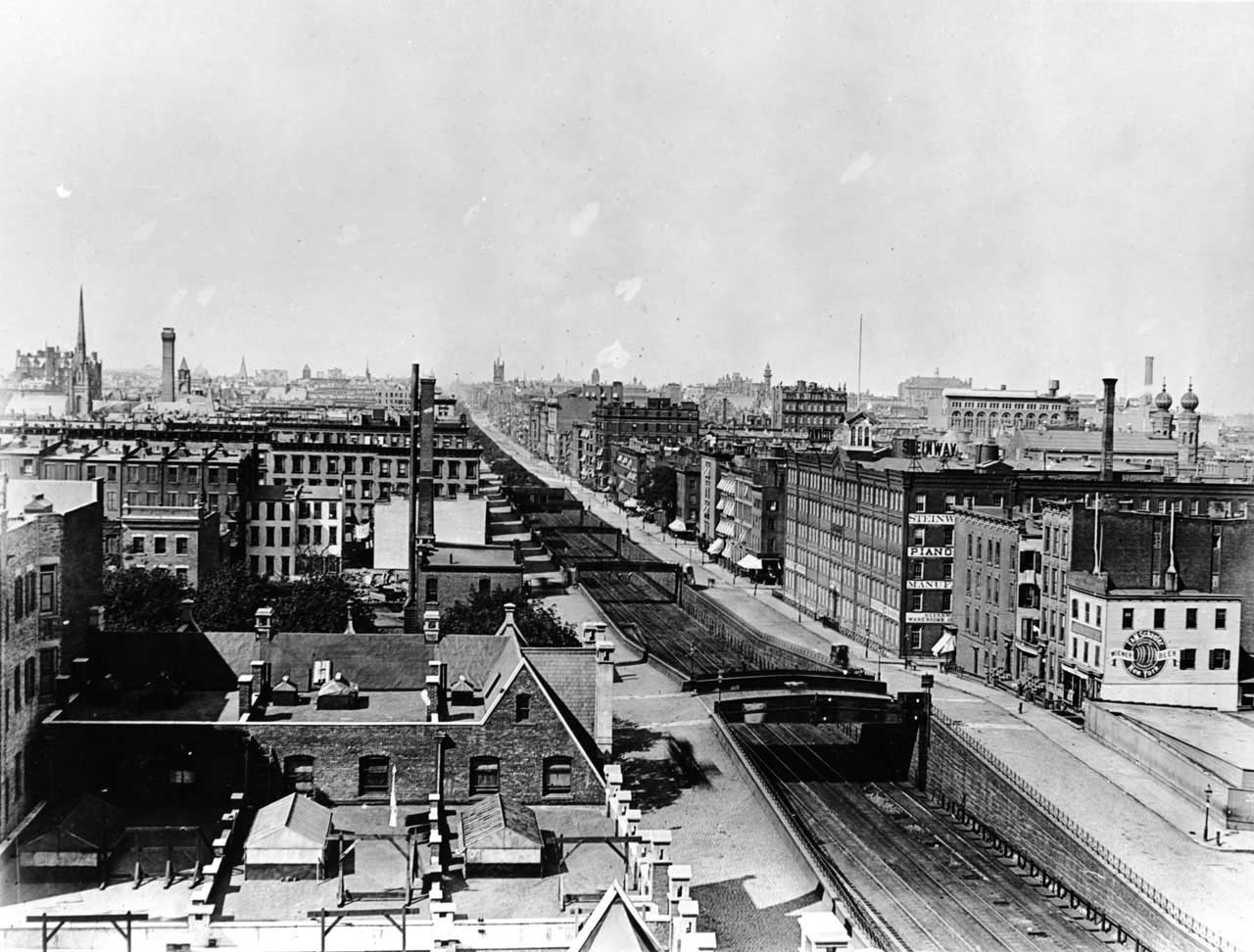
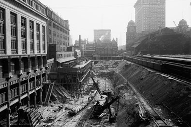
When the New York Central's Chief Engineer William J. Wilgus proposed submerging the railway's tracks under mid-town Manhattan in 1902, it was a radical proposal made possible by the electrification of trains. Steam powered trains needed to be open to the air to dissipate the smoke, ash, and soot produced by their coal or wood burning locomotives. Electrified locomotion and the high cost of Manhattan real estate combined to make Wilgus's proposal for a multi-level underground train yard feasible. It would benefit the city by eliminating the 16-blocks of open cut rail line trenches, a "veritable Chinese Wall," which were a dangerous interruption to the city's streets. The genius of the plan was selling air rights over the train yards to offset the tremendous costs of constructing the underground train yard and platforms, constructing the terminal building, and electrifying the trains. Cornelius Vanderbilt and New York City shared the cost of submerging the rail yard; the air rights paid for electrifying the trains. Undergrounding the tracks allowed New York to continue its northward expansion and transformed what had been the outskirts of the city to its economic and cultural center. Fourth Avenue, a dangerous, noisy, and dirty thoroughfare, became Park Avenue, the city's most posh address. Long distance trains no longer bring a share of the 14 million passengers to GCT each year; today Metro North, the region's commuter rail service, provides service for 82 million regional commuters annually and links them to the NYC subway and bus systems.
The Transbay Transit Center, the San Francisco Bay Area, and California
The TTC will serve as the centerpiece of a new high-density mixed-use neighborhood in what was once a low-rise industrial and commercial area. It will provide transit connections for eight Bay Area counties and the state of California, through the region's 11 transit systems and the future high-speed rail line between San Diego and Sacramento. As I describe in a PA Times column, the Transbay Joint Powers Authority (TJPA) is responsible for financing, design, construction, and operation, with about 23 percent of project funding derived from the sale of publicly owned land in the district. The TJPA was created by the City and County of San Francisco; the Alameda-Contra Costa Transit District, the public transportation authority for western Alameda and Contra Costa Counties; the Peninsula Corridor Joint Powers Board (owner and operator of Caltrain, the Gilroy to San Francisco diesel powered high speed rail line that serves the Silicon Valley); and the California Department of Transportation (Caltrans). California state law allows public agencies to work together by signing joint powers agreements that may be cooperative arrangements among existing agencies or, as with the TJPA, new, separate agencies.
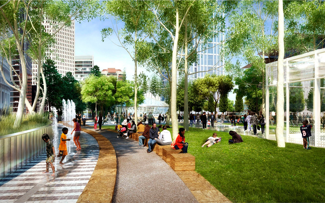
There are three interconnected elements to the Transbay program. The first, scheduled for completion this year, includes constructing the 1-million-square-foot, five-story TTC, with one above-grade bus level, ground-floor and concourse-level retail, foundations for two below-grade rail levels, a 5.4-acre roof-top park, and an elevated bus ramp that will connect to the San Francisco-Oakland Bay Bridge and an off-site bus storage facility.
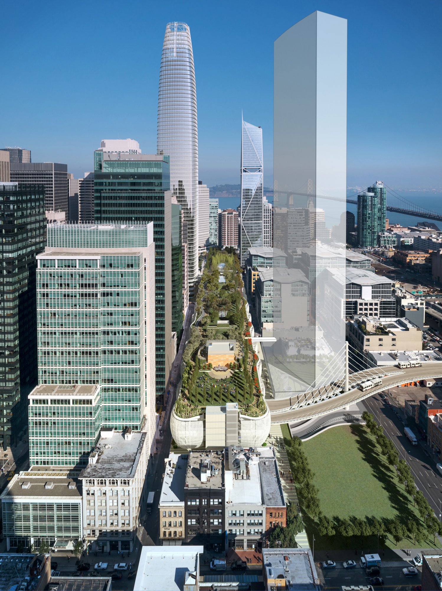
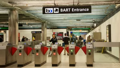
Phase 2 will extend the Caltrain line from its present location at Fourth and Townsend streets, 1.3 miles from the TTC, and build out the two below-grade levels that will serve rail. Presently, the Caltrain station is 1.3 miles from the TTC location—a 25-minute walk or a bus ride away from the SOMA job epicenter. The Lower Concourse will contain retail space, ticketing and waiting areas for rail passengers, connections to an intercity bus terminal for Amtrak and Greyhound, and a one-block-long pedestrian tunnel to the Embarcadero station of BART, the Bay Area Rapid Transit system, and Muni, San Francisco's bus and light rail system. The train platform will contain six tracks and three platforms for Caltrain commuter and high-speed rail service, both to be powered by electricity.

The third element of the Transbay program is development of a new neighborhood that will be guided by the TTC Transit Center District Plan and the Transbay Redevelopment Plan. Highlights of these plans include approximately 6 million square feet of new downtown office space; 4,400 units of new housing, 28 percent of which will be permanently affordable; 100,000 square feet of new retail space, mostly in the TTC; and 1,000 new hotel rooms. The new neighborhood will feature wide sidewalks and mid-block crossings for the alleyways that characterize the SOMA district, safe bicycle lanes, and six acres of new public parks, in addition to the TTC's 5.4-acre rooftop park.
Are the Transbay Transit Center and Grand Central Terminal Comparable?
Manhattan and San Francisco share geographic complexity. Manhattan is an island, separated from the mainland by rivers; San Francisco is the tip of a peninsula, separated from the mainland by the bay. William J. Wilgus believed that rail and transit would support the growth necessary to New York City's continued economic dominance. Many Californians believe that transit is the solution to the congestion that threatens the state and region's continued economic success. Grand Central Terminal succeeded beyond Cornelius Vanderbilt and city leaders' aspirations. The TTC will succeed in making the commute to the locus of the region's greatest concentration of jobs easier for workers throughout the Bay Area. As the Association of Bay Area Governments and the Metropolitan Transportation Commission notes in its "Draft Plan Bay Area 2013 Final Forecast of Jobs, Population and Housing," between 2010 and 2040, the nine-county San Francisco Bay Area is projected to add 1.1 million jobs, 2.1 million people and 660,000 homes, for a total of 4.5 million jobs, 9.3 million people and 3.4 million homes. The growth of the professional services sector is expected to result in more jobs in the downtowns of the region's three largest cities, San Francisco, Oakland, and San Jose. Thirty-four per cent of the increase in job growth will be in San Francisco, with 16 percent of that increase in the TTC district. SOMA's newly constructed skyscraping towers and renovated older buildings are already increasing the amount of first class office space for world-class tenants such as Salesforce, Pinterest, Airbnb, Lending Club, and Uber.
Housing in the new neighborhood will reflect the commitment of city and regional policy to including a share of permanently affordable units in all newly built housing developments. The TTC may not challenge the storied Grand Central Terminal of the radio drama series, "Grand Central Station" [mp3] broadcast from 1937 to 1954, with an opening announcement proclaiming that Grand Central was "the crossroads of a million private lives, a gigantic stage on which are played a thousand dramas daily." The TTC will bustle with too much activity to allow Netfix or Amazon to use it as a location for dramatizing the lives of commuters from Novato, Pinole, and Redwood City. But, like Grand Central, the TTC will play an important role in providing the infrastructure necessary for continued growth in its district and region.

California Lawmakers Withdraw Connect Bay Area Act
The proposal would have merged the Bay Area’s 27 transit agencies into one regional entity.
U.S. Transit Agencies Still in Need of a Long-Term Solution to the Looming ‘Fiscal Cliff’
San Francisco and New York exemplify the political challenges in finding long-term finding solutions for public transit in the post-pandemic United States.

A Transit Ridership Role Reversal in California
Since the outset of the pandemic, the capital of car-oriented sprawl in California has become the king of public transit. Looking for lessons about the future of public transit in the United States? Look to San Francisco and Los Angeles.

Study: Maui’s Plan to Convert Vacation Rentals to Long-Term Housing Could Cause Nearly $1 Billion Economic Loss
The plan would reduce visitor accommodation by 25,% resulting in 1,900 jobs lost.

Alabama: Trump Terminates Settlements for Black Communities Harmed By Raw Sewage
Trump deemed the landmark civil rights agreement “illegal DEI and environmental justice policy.”

Why Should We Subsidize Public Transportation?
Many public transit agencies face financial stress due to rising costs, declining fare revenue, and declining subsidies. Transit advocates must provide a strong business case for increasing public transit funding.

Paris Bike Boom Leads to Steep Drop in Air Pollution
The French city’s air quality has improved dramatically in the past 20 years, coinciding with a growth in cycling.

Why Housing Costs More to Build in California Than in Texas
Hard costs like labor and materials combined with ‘soft’ costs such as permitting make building in the San Francisco Bay Area almost three times as costly as in Texas cities.

San Diego County Sees a Rise in Urban Coyotes
San Diego County experiences a rise in urban coyotes, as sightings become prevalent throughout its urban neighbourhoods and surrounding areas.
Urban Design for Planners 1: Software Tools
This six-course series explores essential urban design concepts using open source software and equips planners with the tools they need to participate fully in the urban design process.
Planning for Universal Design
Learn the tools for implementing Universal Design in planning regulations.
Smith Gee Studio
Alamo Area Metropolitan Planning Organization
City of Santa Clarita
Institute for Housing and Urban Development Studies (IHS)
City of Grandview
Harvard GSD Executive Education
Toledo-Lucas County Plan Commissions
Salt Lake City
NYU Wagner Graduate School of Public Service