


Public transit agencies don't normally get the kind of fine-grained location and navigation data made possible by tracking phones. London got temporary access to that info at the end of 2016, however.
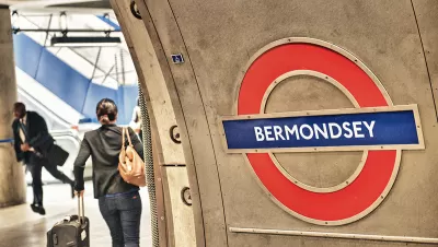
James O'Malley reports on the results of a pilot project conducted at the end of 2016 in London: between November 21 and December 19, Transport for London (TfL) tracked the phone on anyone with a WiFi connection enabled while navigating the London Underground.
O'Malley got the first crack at the "utterly fascinating findings that the agency has been able to make from all of our data," while acknowledging that TfL has to justify the collection of all this data.
"Perhaps the number one reason to do the trial was to better understand the journeys that people actually make on the Tube," writes O'Malley in relaying the case made by officials at TfL. The new WiFi data, combined with existing sources of data, offers new insight into route tracking, in-station tracking, and, in a potentially more controversial use for the tracking, data for advertisers.
The first two benefits of the tracking should help with site and system planning efforts in the future, and O'Malley digs into some of the data shared by TfL to get an idea of how the data might improve planning efforts in the future.
FULL STORY: Here's What TfL Learned From Tracking Your Phone On the Tube


How London's Leading on Transit Data
Transport for London is forging ahead on several projects to collect and use more rider data. One initiative draws on WiFi connections to map users' paths through the London Underground.

Biking in London Grew by 20 Percent Since 2019
Pandemic-induced changes and improved bike infrastructure have contributed to the impressive growth of cycling as a mode share.
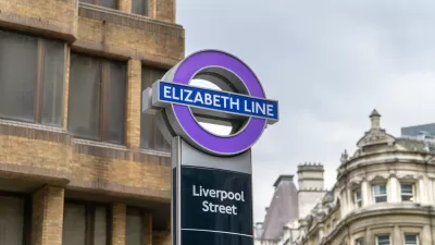
$22 Billion Elizabeth Line Finally Opens in London, With the Queen in Attendance
May 17, 2022 was a big day for transit in London.

Study: Maui’s Plan to Convert Vacation Rentals to Long-Term Housing Could Cause Nearly $1 Billion Economic Loss
The plan would reduce visitor accommodation by 25,% resulting in 1,900 jobs lost.

Alabama: Trump Terminates Settlements for Black Communities Harmed By Raw Sewage
Trump deemed the landmark civil rights agreement “illegal DEI and environmental justice policy.”

North Texas Transit Leaders Tout Benefits of TOD for Growing Region
At a summit focused on transit-oriented development, policymakers discussed how North Texas’ expanded light rail system can serve as a tool for economic growth.

San Diego County Sees a Rise in Urban Coyotes
San Diego County experiences a rise in urban coyotes, as sightings become prevalent throughout its urban neighbourhoods and surrounding areas.

Los Angeles County Invests in Wildfire Recovery for Parks, Trails, and Open Space
The $4.25 million RESTORE Program supports the recovery of parks, trails, and open spaces damaged by the January 2025 wildfires through targeted grants that promote community healing, wildfire resilience, and equitable access to nature.

Nevada Bills Aim to Establish Home Insurance Assurance Amidst Wildfire Risk
Republican sponsor hopes the FAIR plan would be “a true market of last resort.”
Urban Design for Planners 1: Software Tools
This six-course series explores essential urban design concepts using open source software and equips planners with the tools they need to participate fully in the urban design process.
Planning for Universal Design
Learn the tools for implementing Universal Design in planning regulations.
Smith Gee Studio
Alamo Area Metropolitan Planning Organization
City of Santa Clarita
Institute for Housing and Urban Development Studies (IHS)
City of Grandview
Harvard GSD Executive Education
Toledo-Lucas County Plan Commissions
Salt Lake City
NYU Wagner Graduate School of Public Service