


The D.C. Streetcar wraps up 2016 with positive news for its ridership numbers, as well as a positive effect on the nearby transit system.
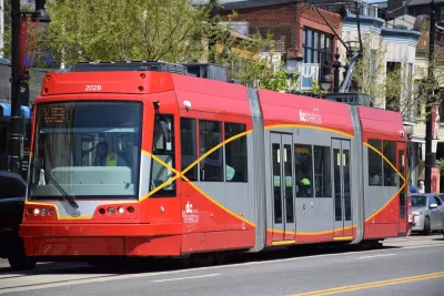
"DC’s two-mile streetcar route overlaps two popular Metrobus lines, the X2 and X9, and when the streetcar started some wondered whether it would poach those lines’ riders," writes Bryan Rodda to build tension for the big reval. That is, "it turns out overall transit ridership along the H Street/Benning Road corridor is up 15% since February."
The WMATA revealed the data on the streetcar and the bus lines in a blog post on December 12, finding that the streetcar had not cannibalized the bus routes it shares the street with for two miles along H Street. "The result is an increase in total transit use of the bus lines and streetcar combined, not a substitution of one service for another," explains Rodda. "Boardings along the H Street-Benning Road corridor now approach 17,000 per day."
The D.C. Streetcar opened in February, earning positive ridership reviews in August—those accomplishments after years of being called a boondoggle, "worse than nothing," and slower than walking.
FULL STORY: DC Streetcar ridership is growing, and people are still riding the X2 and X9 buses, too

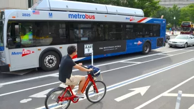
Report Lays Out a New Path for Bus Service in the D.C. Region
Ridership on the WMATA bus system, down an estimated 13 percent between 2012 and 2017, will need drastic innovations to reverse, according to a new report by the Bus Transformation project.

Density Increases Near Transit Station in D.C. But Ridership Does Not
D.C.'s ridership is down even as density around stations is up. More residents are choosing to drive or bike.
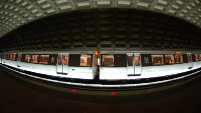
D.C. Metro Will End Late-Night Rail Service for Two Years
A tough decision that has been on the table since the summer has now been made official by the WMATA's board of directors.

Study: Maui’s Plan to Convert Vacation Rentals to Long-Term Housing Could Cause Nearly $1 Billion Economic Loss
The plan would reduce visitor accommodation by 25,% resulting in 1,900 jobs lost.

North Texas Transit Leaders Tout Benefits of TOD for Growing Region
At a summit focused on transit-oriented development, policymakers discussed how North Texas’ expanded light rail system can serve as a tool for economic growth.

Using Old Oil and Gas Wells for Green Energy Storage
Penn State researchers have found that repurposing abandoned oil and gas wells for geothermal-assisted compressed-air energy storage can boost efficiency, reduce environmental risks, and support clean energy and job transitions.

Private Donations Propel Early Restoration of Palisades Playground
Los Angeles has secured over $1.3 million in private funding to restore the Pacific Palisades playground months ahead of schedule, creating a modern, accessible space that supports community healing after recent wildfires.

From Blight to Benefit: Early Results From California’s Equitable Cleanup Program
The Equitable Community Revitalization Grant (ECRG) program is reshaping brownfield redevelopment by prioritizing projects in low-income and environmental justice communities, emphasizing equity, transparency, and community benefits.

Planting Relief: Tackling Las Vegas Heat One Tree at a Time
Nevada Plants, a Las Vegas-based nonprofit, is combating the city’s extreme urban heat by giving away trees to residents in underserved neighborhoods, promoting shade, sustainability, and community health.
Urban Design for Planners 1: Software Tools
This six-course series explores essential urban design concepts using open source software and equips planners with the tools they need to participate fully in the urban design process.
Planning for Universal Design
Learn the tools for implementing Universal Design in planning regulations.
Ascent Environmental
Borough of Carlisle
Institute for Housing and Urban Development Studies (IHS)
City of Grandview
Harvard GSD Executive Education
Toledo-Lucas County Plan Commissions
Salt Lake City
NYU Wagner Graduate School of Public Service