


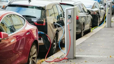
Data collection used for planning purposes has traditionally focused on cars, rather than people. So far, innovative transportation technologies seem unconcerned with changing that pattern.

Joe Cortright cautions against the dangers in over-estimating the value of data in planning decisions. Though a believer in using data to inform decision making and problem solving, Cortright reminds us that "sometimes the quantitative data that’s available is too limited to enable us to see what’s really going on." Moreover, "incomplete data can lead us to the wrong conclusions."
Cortright chooses the case study of walkability to examine the shortcomings of traditional planning data. After examining reports of the pedestrian experience in Houston (and similar conditions around the country), Cortright states the problem: "Because we lack the conventional metrics to define and measure, for example, the hardships of walking, we don’t design and enforce solutions or adopt targeted public policies."
Further distorting the focus of planning and engineers is an overabundance of data on car traffic: "we have parking standards, traffic counts, speed studies, and 'level of service standards,'" and "[t]raffic engineers will immediately tell us when a road is substandard, or its pavement has deteriorated, or its level of service has become (or might someday become) degraded."
The implications of Cortright's argument reach into the future, however, and this is where planners have the power to demand more from policy makers. Recall the recent criticism of the city of Columbus' selection for $50 million in grant money from the U.S. Department of Transportation's Smart City competition—awarded for a project proposal that focuses on autonomous vehicles, rather than public, mass transit. Cortright's concern with the priority on self-driving cars and other futuristic technology:
New technology promises to provide a firehose of data about cars, car travel, car delay, and roadways—but not nearly as much about people. This is a serious omission, and should give us pause about the application of “smart” principles to cities and transportation planning.
FULL STORY: The limits of data-driven approaches to planning

Tech Trends for Cities and States
Smart cities technology is well behind schedule, but the technology industry hasn’t given up on new digital solutions, self-driving cars, curb management, and AI-powered systems.

A More Complete Picture of the 'Smart City' Plans in Toronto
The game changing redevelopment proposed by Sidewalk Labs for the Toronto waterfront district of Quayside took new shape recently after the company presented an updated draft of its plan.

How Data Privatization Will Change Planning Practice
Planners will be presented with new challenges and opportunities in a new era of data-enhanced government.

Alabama: Trump Terminates Settlements for Black Communities Harmed By Raw Sewage
Trump deemed the landmark civil rights agreement “illegal DEI and environmental justice policy.”

Study: Maui’s Plan to Convert Vacation Rentals to Long-Term Housing Could Cause Nearly $1 Billion Economic Loss
The plan would reduce visitor accommodation by 25% resulting in 1,900 jobs lost.

Planetizen Federal Action Tracker
A weekly monitor of how Trump’s orders and actions are impacting planners and planning in America.

Study Links Covid and Poor Driving
The effects of the virus, including ‘brain fog,’ can make driving more difficult and dangerous.

Waymo Gets Permission to Map SF’s Market Street
If allowed to operate on the traffic-restricted street, Waymo’s autonomous taxis would have a leg up over ride-hailing competitors — and counter the city’s efforts to grow bike and pedestrian on the thoroughfare.

Parklet Symposium Highlights the Success of Shared Spaces
Parklets got a boost during the Covid-19 pandemic, when the concept was translated to outdoor dining programs that offered restaurants a lifeline during the shutdown.
Urban Design for Planners 1: Software Tools
This six-course series explores essential urban design concepts using open source software and equips planners with the tools they need to participate fully in the urban design process.
Planning for Universal Design
Learn the tools for implementing Universal Design in planning regulations.
Caltrans
Smith Gee Studio
Institute for Housing and Urban Development Studies (IHS)
City of Grandview
Harvard GSD Executive Education
Toledo-Lucas County Plan Commissions
Salt Lake City
NYU Wagner Graduate School of Public Service