


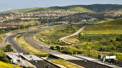
In the 1950s, southern Orange County, California was a place of open hills, citrus groves, and scattered towns. The I-5 Freeway changed that, paving the way for today's subdivisions.
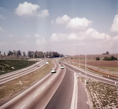
Running parallel to the coast through the heart of the county, the I-5 Freeway follows the path of the El Camino Real, a famed route from California's Spanish period. "If Orange County had a skeleton, the 5 freeway would be its spine. [...] No other piece of infrastructure so thoroughly binds together the spatial structure of Orange County."
Nathan Masters gives us photos and advertisements from the 1950s, when the freeway was extended past a sparkling new Disneyland, opening up the "Southland." Unlike some L.A. County freeways, the 5 didn't displace residents. "[...] for much of its length, construction crews paved over orange groves, bean fields, and cattle pastures rather than residential neighborhoods; when construction began, Orange County was a decidedly rural place, an agricultural landscape dotted by a few small towns, distinct from the Los Angeles metropolis."
"Its backbone in place, Orange County soon evolved from its rural, embryonic form (1950 population: 216,224) into the fully realized postmodern metropolis (2010 population: 3,010,232) we know today." The 5, also known as the Santa Ana Freeway, now runs the length of the country from Mexico to Canada.
FULL STORY: How the 5 Freeway Made Orange County Suburban

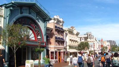
What Will Disneyland Be Like When it Reopens?
According to a study, Disneyland could comfortably accommodate 50% of the 110-acre theme park’s pre-COVID-19 attendance capacity.
Plans Advance for Orange County Streetcar
The $289 million streetcar would serve the cities of Santa Ana (population 329,00), county seat and second densest in California after San Francisco, and Garden Grove (population 170,000) on a 4.1-mile route. Service could begin 2020.
A Pedestrian's Perspective on Sprawling Orange County
Southern California's Orange County isn't exactly known for its walkability. Frank H. Wu decided to test that notion on a recent carless visit.

Study: Maui’s Plan to Convert Vacation Rentals to Long-Term Housing Could Cause Nearly $1 Billion Economic Loss
The plan would reduce visitor accommodation by 25,% resulting in 1,900 jobs lost.

Alabama: Trump Terminates Settlements for Black Communities Harmed By Raw Sewage
Trump deemed the landmark civil rights agreement “illegal DEI and environmental justice policy.”

North Texas Transit Leaders Tout Benefits of TOD for Growing Region
At a summit focused on transit-oriented development, policymakers discussed how North Texas’ expanded light rail system can serve as a tool for economic growth.

How Community Science Connects People, Parks, and Biodiversity
Community science engages people of all backgrounds in documenting local biodiversity, strengthening connections to nature, and contributing to global efforts like the City Nature Challenge to build a more inclusive and resilient future.

Alabama: Trump Terminates Settlements for Black Communities Harmed By Raw Sewage
Trump deemed the landmark civil rights agreement “illegal DEI and environmental justice policy.”

Dear Tesla Driver: “It’s not You, It’s Him.”
Amidst a booming bumper sticker industry, one writer offers solace to those asking, “Does this car make me look fascist?”
Urban Design for Planners 1: Software Tools
This six-course series explores essential urban design concepts using open source software and equips planners with the tools they need to participate fully in the urban design process.
Planning for Universal Design
Learn the tools for implementing Universal Design in planning regulations.
City of Santa Clarita
Ascent Environmental
Institute for Housing and Urban Development Studies (IHS)
City of Grandview
Harvard GSD Executive Education
Toledo-Lucas County Plan Commissions
Salt Lake City
NYU Wagner Graduate School of Public Service