


OpenGrid gathers together Chicago's open data, letting users specify areas of focus on a map of the city. Users can also overlay different datasets on the same map.

Chicago's open data community have already created tools to curate what the city makes public. OpenGrid is an effort by the city to collect that data and make it more accessible. Whet Moser writes, "It's an interface for the city's open data that allows users to run their searches off a map, creating their own geographies as they go and mashing up data as they wish."
Prior to OpenGrid, the city used a similar tool called WindyGrid to help plan events, services, and public safety. "With backing from Bloomberg Philanthropies and hosting by the Smart Chicago Collaborative, the city built a public version—OpenGrid—atop Plenar.io, an open-source infrastructure for open data."
Brenna Berman, Chicago's chief information officer, sees OpenGrid as a way for researchers to define neighborhoods and communities independently from official distinctions. "'Lots of people, the neighborhood that they recognize is not in their ward or community area,' Berman says. 'The polygon that I'd draw crosses two wards and community areas. These formal things are not where we live.'"
FULL STORY: Want Chicago Data? OpenGrid Makes It Easier Than Ever

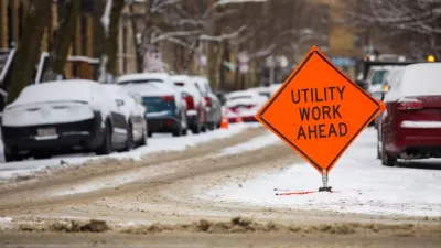
A Website to Report and Map Street Repair Work
The ChiSreetWork website, which updates the location of street repairs and was originally intended for internal use at City Hall, is now publicly available in Chicago.

First City to Make Ride-Hailing Trip Data Public: Chicago
Data geeks in Chicago will get the first chance to crunch detailed data on transportation network company trips in their city.

DataUSA: An Intuitive Tool for Public Data
A collaboration between Deloitte, Datawheel, and MIT has produced an intuitive aesthetically-pleasing gathering point for public data in the United States. Specific locations and industries boast easy-to-read profiles.

Alabama: Trump Terminates Settlements for Black Communities Harmed By Raw Sewage
Trump deemed the landmark civil rights agreement “illegal DEI and environmental justice policy.”

Study: Maui’s Plan to Convert Vacation Rentals to Long-Term Housing Could Cause Nearly $1 Billion Economic Loss
The plan would reduce visitor accommodation by 25% resulting in 1,900 jobs lost.

Planetizen Federal Action Tracker
A weekly monitor of how Trump’s orders and actions are impacting planners and planning in America.

Waymo Gets Permission to Map SF’s Market Street
If allowed to operate on the traffic-restricted street, Waymo’s autonomous taxis would have a leg up over ride-hailing competitors — and counter the city’s efforts to grow bike and pedestrian on the thoroughfare.

Parklet Symposium Highlights the Success of Shared Spaces
Parklets got a boost during the Covid-19 pandemic, when the concept was translated to outdoor dining programs that offered restaurants a lifeline during the shutdown.

Federal Homelessness Agency Places Entire Staff on Leave
The U.S. Interagency Council on Homelessness is the only federal agency dedicated to preventing and ending homelessness.
Urban Design for Planners 1: Software Tools
This six-course series explores essential urban design concepts using open source software and equips planners with the tools they need to participate fully in the urban design process.
Planning for Universal Design
Learn the tools for implementing Universal Design in planning regulations.
Caltrans
Smith Gee Studio
Institute for Housing and Urban Development Studies (IHS)
City of Grandview
Harvard GSD Executive Education
Toledo-Lucas County Plan Commissions
Salt Lake City
NYU Wagner Graduate School of Public Service