


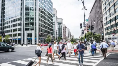
In Canadian cities, rising income inequality has been reflected in neighborhood polarization. The experience of Hamilton, Ontario, has been typical. Here, inner-city decline is now giving way to gentrification, displacing poverty to the suburbs.
In general, from the 1960s onwards, Canadian cities have seen a growing polarization of incomes which has been reflected in a polarization of neighborhoods. Hamilton, Ontario, a mid-sized industrial centre 50 miles from Toronto, has been typical. In 1970, most neighborhoods were middle-income in character. Since then, a steadily growing proportion have become either poor or affluent.
The geographical pattern of change in Hamilton has been more typical of cities in the northeastern U.S. than in Canada. The decline of steel production and of other manufacturing hit the city hard. A sequence of maps shows that from 1970 through 2010, neighborhood polarization was expressed in a growing contrast between inner city and 'suburbs', although this term doesn't mean quite the same as in the United States because a provincially-mandated amalgamation in 2000 merged the City with all major suburban municipalities.
In the past decade, however, Hamilton's inner city has begun to turn around. Some neighbourhoods adjacent to the downtown have begun to revive. There is much talk, and growing evidence, of gentrification. To a large extent, this has been due to the prosperity and growth of Hamilton's neighbor, Toronto. Planners and politicians now talk of the 'GTHA' (Greater Toronto-Hamilton Area). Driven away by a property boom, an increasing number of Torontonians are relocating to Hamilton and reviving inner-city neighbourhoods there in a manner that began in Toronto almost half a century ago. In a unique context, another North American industrial centre is reviving, but displacing poverty to poorly-serviced inner suburbs.
A recent report, written by Richard Harris, Jim Dunn and Sarah Wakefield [pdf], has summarized these trends. The report is part of a series of reports on neighborhood change in Canadian cities that is being produced by the Neighbourhood Change Research Partnership at the University of Toronto. Over the years, changes in Hamilton have been well-covered by a local daily newspaper, the Hamilton Spectator. Very recently, the Spectator ran a series of articles on the geography of poverty in which they revisited and updated a series of articles published a decade ago. The final article in the series is available here.
FULL STORY: A City on the Cusp: Neighbourhood Change in Hamilton since 1970

How Do Neighborhoods Become Wealthy?
A new study by the Federal Reserve Bank of Cleveland examines a “troubling consistency” of neighborhoods—that is that over the past 30 years, the poorest neighborhoods have stayed that way.
Census Data: Black Americans Leaving Cities for Suburbs
The trend of Black Americans leaving urban areas for suburban communities mirrors the White Flight of the mid-20th century but for vastly different reasons and with vastly different consequences.

What We Really Mean When We Say Gentrification
The focus on gentrifying communities has, in many cases, eclipsed the similar problems facing more stagnant neighborhoods.

Alabama: Trump Terminates Settlements for Black Communities Harmed By Raw Sewage
Trump deemed the landmark civil rights agreement “illegal DEI and environmental justice policy.”

Study: Maui’s Plan to Convert Vacation Rentals to Long-Term Housing Could Cause Nearly $1 Billion Economic Loss
The plan would reduce visitor accommodation by 25% resulting in 1,900 jobs lost.

Planetizen Federal Action Tracker
A weekly monitor of how Trump’s orders and actions are impacting planners and planning in America.

Waymo Gets Permission to Map SF’s Market Street
If allowed to operate on the traffic-restricted street, Waymo’s autonomous taxis would have a leg up over ride-hailing competitors — and counter the city’s efforts to grow bike and pedestrian on the thoroughfare.

Parklet Symposium Highlights the Success of Shared Spaces
Parklets got a boost during the Covid-19 pandemic, when the concept was translated to outdoor dining programs that offered restaurants a lifeline during the shutdown.

Federal Homelessness Agency Places Entire Staff on Leave
The U.S. Interagency Council on Homelessness is the only federal agency dedicated to preventing and ending homelessness.
Urban Design for Planners 1: Software Tools
This six-course series explores essential urban design concepts using open source software and equips planners with the tools they need to participate fully in the urban design process.
Planning for Universal Design
Learn the tools for implementing Universal Design in planning regulations.
Caltrans
Smith Gee Studio
Institute for Housing and Urban Development Studies (IHS)
City of Grandview
Harvard GSD Executive Education
Toledo-Lucas County Plan Commissions
Salt Lake City
NYU Wagner Graduate School of Public Service