


Esri offers insights into five new ways to analyze the success of transit service in cities of all kinds.
"Who are the people served by your city’s transit system? And who isn’t, but should be? How does transit change throughout the day? And what is the best way to analyze service areas?" These are the type of questions communities should be asking as they invest in public transit, according to Jennifer Bell, writing a post for Esri. The article explains the concepts behind five new ways to look at transit, as enabled by transit analysis technology.
- "Use Service Areas instead of Buffers."
- Transit trips per hour.
- Travel times changing during the day.
- Travel times to destinations.
- Adding demographic variables.
The article also includes a story map to illustrate these new ways looking at transit when examining a case study provided transit access to public libraries in Chicago, Illinois and transit availability in Ann Arbor, Michigan.
FULL STORY: 5 New Ways to View Transit

New Frequent Buses Will Arrive More Frequently in Seattle
A few weeks after a major restructure of bus service, King County Metro Transit in Seattle is adding additional bus trips to a few particularly crowded lines.
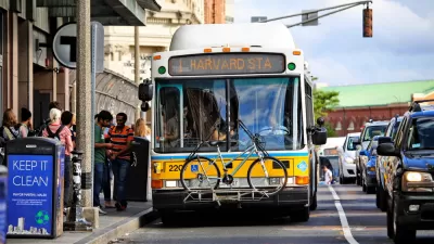
MBTA Announces Improved Bus Frequencies, Redesigned Route Map in Boston
A large system redesign is nearing implementation in and around Boston, but the new system map will require more drivers than the MBTA currently employs.
Latest 'Muni Forward' Changes Mean Route Changes, Frequency Improvements
Muni will soon launch the fourth phase of improvement to San Francisco's transit system.

Alabama: Trump Terminates Settlements for Black Communities Harmed By Raw Sewage
Trump deemed the landmark civil rights agreement “illegal DEI and environmental justice policy.”

Planetizen Federal Action Tracker
A weekly monitor of how Trump’s orders and actions are impacting planners and planning in America.

Why Should We Subsidize Public Transportation?
Many public transit agencies face financial stress due to rising costs, declining fare revenue, and declining subsidies. Transit advocates must provide a strong business case for increasing public transit funding.

Judge Orders Release of Frozen IRA, IIJA Funding
The decision is a victory for environmental groups who charged that freezing funds for critical infrastructure and disaster response programs caused “real and irreparable harm” to communities.

‘Clybourne Park’ Sets Stage for Housing Equity Discussions
Clybourne Park, a play exploring race, real estate, and community tensions, can set the stage for discussion on the lasting impacts of housing discrimination, gentrification, and the fight for affordability.

Understanding Road Diets
An explainer from Momentum highlights the advantages of reducing vehicle lanes in favor of more bike, transit, and pedestrian infrastructure.
Urban Design for Planners 1: Software Tools
This six-course series explores essential urban design concepts using open source software and equips planners with the tools they need to participate fully in the urban design process.
Planning for Universal Design
Learn the tools for implementing Universal Design in planning regulations.
Caltrans
Smith Gee Studio
Institute for Housing and Urban Development Studies (IHS)
City of Grandview
Harvard GSD Executive Education
Toledo-Lucas County Plan Commissions
Salt Lake City
NYU Wagner Graduate School of Public Service