


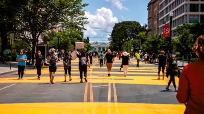
Route Fifty created a ranking system to judge the "gravitas" of each of the avenues in the nation's capital named after the 50 states in the Union.
Michael Grass describes the idea behind a recent exercise in evaluating the streets of Washington D.C.:
"What if you could rank the 50 states based on the location and characteristics of their corresponding state-named avenue in the District of Columbia? Essentially, this would be a measure of state identity gravitas—if that is something that could be indeed measured."
It's no secret that some state avenues intersect with some wildly attractive real estate—but they can't all front the White House, can they Pennsylvania Avenue? Here are the metrics that contributed to the ranking:
- How many quadrants does the state avenue pass through?
- Is the state an "Original 13" colony?
- Is the state-named thoroughfare in the original L’Enfant-designed city?
- Does the state avenue radiate from the White House or U.S. Capitol building?
- How many important junctions—traffic circles, squares and other potentially monumental intersections—does the state avenue connect?
- How many intersections are there with other state-named thoroughfares?
- Is the state-named thoroughfare physically interrupted?
- Is the state-named thoroughfare not technically an Avenue?
- Does the state-named thoroughfare cross the state line into Maryland and retain its name?
- What is the state-named thoroughfare’s length in miles?
After running all of the avenues through the methodology, Grass determines that the state at the top fo the list is Massachusetts, followed by Pennsylvania and Connecticut. Bringing up the rear is one of the state-named public right of ways that didn't warrant the title "Avenue": California.
Given California's position at the very, very bottom of the list, Grass begins the article with some discussion about whether a state of such prominence as California is worthy of an Avenue more reflective of its contributions to the Union.
Hat tip to David Alpert at Greater Greater Washington for sharing the news about the ranking.
FULL STORY: How Do the 50 States Stack Up According to Their ‘State Avenue Gravitas’ in D.C.?


Friday Fun: Ceci N’est Pas une Rue
When allowing a crowd to decide the name of something important, make sure to add a layer of self-control.
D.C. Revamps its Vision Zero Plan to Eliminate Traffic Fatalities
Washington, D.C. was an early adopter of Vision Zero in the United States, but eventually it became emblematic of the country's lack of progress in reducing traffic collisions.
D.C. Region Sets Goal to Reduce GHG Emissions From Transportation 50% by 2030
Transportation is the largest source of greenhouse gas emissions in the D.C. region—and the rest of the country. The D.C. region is committing to drastic actions to change their ways, however.

Alabama: Trump Terminates Settlements for Black Communities Harmed By Raw Sewage
Trump deemed the landmark civil rights agreement “illegal DEI and environmental justice policy.”

Study: Maui’s Plan to Convert Vacation Rentals to Long-Term Housing Could Cause Nearly $1 Billion Economic Loss
The plan would reduce visitor accommodation by 25% resulting in 1,900 jobs lost.

Planetizen Federal Action Tracker
A weekly monitor of how Trump’s orders and actions are impacting planners and planning in America.

Waymo Gets Permission to Map SF’s Market Street
If allowed to operate on the traffic-restricted street, Waymo’s autonomous taxis would have a leg up over ride-hailing competitors — and counter the city’s efforts to grow bike and pedestrian on the thoroughfare.

Parklet Symposium Highlights the Success of Shared Spaces
Parklets got a boost during the Covid-19 pandemic, when the concept was translated to outdoor dining programs that offered restaurants a lifeline during the shutdown.

Federal Homelessness Agency Places Entire Staff on Leave
The U.S. Interagency Council on Homelessness is the only federal agency dedicated to preventing and ending homelessness.
Urban Design for Planners 1: Software Tools
This six-course series explores essential urban design concepts using open source software and equips planners with the tools they need to participate fully in the urban design process.
Planning for Universal Design
Learn the tools for implementing Universal Design in planning regulations.
Caltrans
Smith Gee Studio
Institute for Housing and Urban Development Studies (IHS)
City of Grandview
Harvard GSD Executive Education
Toledo-Lucas County Plan Commissions
Salt Lake City
NYU Wagner Graduate School of Public Service