


A recent post on Mobility Lab explains some of the challenges developers encounter when creating the multi-modal trip planner apps of our dreams.
Trevor Gerhardt, a developer with Conveyal who works with OpenTripPlanner, shares some of the problems that arise for plotting multi-modal routes on mobile apps.
Gerhardt introduces the difficulties in multi-modal trip planning by explaining the process by which his team has refined the process for the Washington, D.C.-focused app CarFreeAtoZ: "In the backend of CarFreeAtoZ, we take our search a step further and use subjective values to rank each option based on more than just time. This allows us to tailor options to each commuter as well as the full community in aggregate, instead of just showing the fastest possible trip by default. It also creates a split where we determine which routes to prune by objective measures and which to score and re-rank with subjective ones."
Gerhardt goes on to explain that such a process creates several categories of challenges, including "bike-to-transit pushing out walk-to-transit," "longer transit wait times than ride times," and "when to hide drive-to-transit results." Gerhardt also explains the CarFreeAtoZ approach to each of these challenges and solicits feedback on the routes provided by that system.
FULL STORY: 3 Ways Multi-Modal Travel is Tricky for App Developers

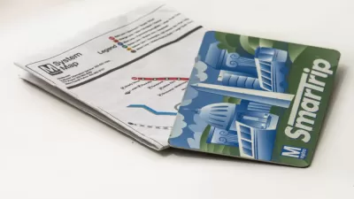
Smartphone Fare Cards Now Available for D.C. Metro
The future is now.
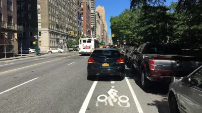
Volunteers Count Almost 700 Vehicles Blocking D.C. Bike Lanes in One Day
Forget bike counts. The new thing in bike advocacy is cars-blocking-the-bike-lane counts.
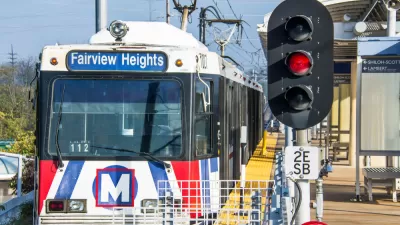
The Transit App Now the Transit App for All of St. Louis
The Transit app will replace the Metro on the Go app for multi-modal trip planning around St. Louis.

Study: Maui’s Plan to Convert Vacation Rentals to Long-Term Housing Could Cause Nearly $1 Billion Economic Loss
The plan would reduce visitor accommodation by 25,% resulting in 1,900 jobs lost.

North Texas Transit Leaders Tout Benefits of TOD for Growing Region
At a summit focused on transit-oriented development, policymakers discussed how North Texas’ expanded light rail system can serve as a tool for economic growth.

Why Should We Subsidize Public Transportation?
Many public transit agencies face financial stress due to rising costs, declining fare revenue, and declining subsidies. Transit advocates must provide a strong business case for increasing public transit funding.

How Community Science Connects People, Parks, and Biodiversity
Community science engages people of all backgrounds in documenting local biodiversity, strengthening connections to nature, and contributing to global efforts like the City Nature Challenge to build a more inclusive and resilient future.

Alabama: Trump Terminates Settlements for Black Communities Harmed By Raw Sewage
Trump deemed the landmark civil rights agreement “illegal DEI and environmental justice policy.”

Dear Tesla Driver: “It’s not You, It’s Him.”
Amidst a booming bumper sticker industry, one writer offers solace to those asking, “Does this car make me look fascist?”
Urban Design for Planners 1: Software Tools
This six-course series explores essential urban design concepts using open source software and equips planners with the tools they need to participate fully in the urban design process.
Planning for Universal Design
Learn the tools for implementing Universal Design in planning regulations.
City of Santa Clarita
Ascent Environmental
Institute for Housing and Urban Development Studies (IHS)
City of Grandview
Harvard GSD Executive Education
Toledo-Lucas County Plan Commissions
Salt Lake City
NYU Wagner Graduate School of Public Service