


File under tools for the tool kit: Jarrett Walker of Human Transit shares details about Nearmap, an aerial photography tool that serves as a helpful alternative to Google Earth.
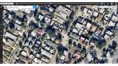
According to Jarrett Walker, "when it comes down to questions of rights-and-lefts, at the lowest level of planning altitude, one source of information is critical: aerial photography."
To aid planners of all stripes in the acquisition of useful aerial photography, Walker shares news of resource called Nearmap, which he describes as "an alternative to Google Earth that has grown more and more impressive. Initially confined to Australia and New Zealand (I used it all the time when I lived there) it now includes all large US cities. The site's best feature is the very recent, high-resolution imagery it offers, but it also has nice image capture and layer overlay tools, all in-browser."
FULL STORY: nearmap brings its high-resolution satellite imagery to the US

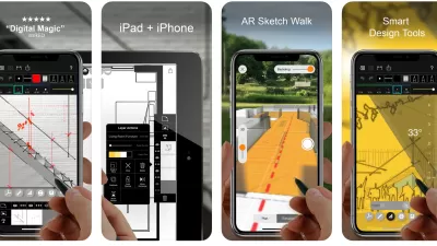
Best Apps for Urban Planning in 2022
Mobile apps continue to redefine the practices of planning—urban planning, regional planning, transportation planning, community planning, and rural planning included.
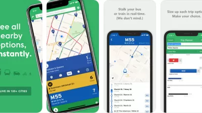
Top Planning Apps for 2019
Insights into the mobile app technology used in the practice and study of planning.
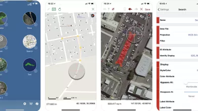
The Best Planning Apps
Planetizen is pleased to present the best of the latest crop of mobile apps by planners and for planners.

Study: Maui’s Plan to Convert Vacation Rentals to Long-Term Housing Could Cause Nearly $1 Billion Economic Loss
The plan would reduce visitor accommodation by 25,% resulting in 1,900 jobs lost.

North Texas Transit Leaders Tout Benefits of TOD for Growing Region
At a summit focused on transit-oriented development, policymakers discussed how North Texas’ expanded light rail system can serve as a tool for economic growth.

Using Old Oil and Gas Wells for Green Energy Storage
Penn State researchers have found that repurposing abandoned oil and gas wells for geothermal-assisted compressed-air energy storage can boost efficiency, reduce environmental risks, and support clean energy and job transitions.

Private Donations Propel Early Restoration of Palisades Playground
Los Angeles has secured over $1.3 million in private funding to restore the Pacific Palisades playground months ahead of schedule, creating a modern, accessible space that supports community healing after recent wildfires.

From Blight to Benefit: Early Results From California’s Equitable Cleanup Program
The Equitable Community Revitalization Grant (ECRG) program is reshaping brownfield redevelopment by prioritizing projects in low-income and environmental justice communities, emphasizing equity, transparency, and community benefits.

Planting Relief: Tackling Las Vegas Heat One Tree at a Time
Nevada Plants, a Las Vegas-based nonprofit, is combating the city’s extreme urban heat by giving away trees to residents in underserved neighborhoods, promoting shade, sustainability, and community health.
Urban Design for Planners 1: Software Tools
This six-course series explores essential urban design concepts using open source software and equips planners with the tools they need to participate fully in the urban design process.
Planning for Universal Design
Learn the tools for implementing Universal Design in planning regulations.
Ascent Environmental
Borough of Carlisle
Institute for Housing and Urban Development Studies (IHS)
City of Grandview
Harvard GSD Executive Education
Toledo-Lucas County Plan Commissions
Salt Lake City
NYU Wagner Graduate School of Public Service