


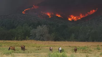
WIFIRE, a real-time and data-driven simulation, prediction, and visualization technology, combines satellite and remote sensor data to forecast the potential spread of wildfires.
As InformationWeek reports, a team of researchers, technologists, and firefighters from the University of California at San Diego and the University of Maryland, with support from the National Science Foundation, have come together to create a far-reaching simulation, visualization, and prediction model for understanding wildfires called WIFIRE. Although still partially in development, WIFIRE has some prototypes and pilot applications now available.
Once completed, WIFIRE will be a vast open network with specialized interfaces and messages sent to receivers. Indeed, according to Elena Malykhina, "having such infrastructure in place would be especially useful during massive environmental events like the wildfires that California firefighters have been battling."
With summer wildfires expected to increase in the next 50 years, WIFIRE is a high-resolution, life-saving data tool with the potential to understand the patterns of wildfires.
FULL STORY: Big Data Tackles Wildfire Control

Wildfires Prompt Forestry Debate on Climate Change
While forests sequester atmospheric carbon dioxide, wildfires release enormous amounts of greenhouse gases as they increase in frequency and intensity from climate change.
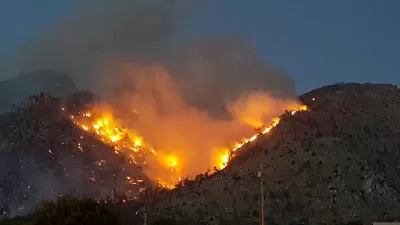
Study: Forest Fires Have Doubled in the Western United States
Wildfires ravaged the western United States again this year, reflecting the new normal of climate change.
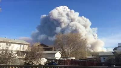
Thank Climate Change and Sprawl for Worsening Wildfires
Along with climate conditions, urban sprawl is intensifying wildfires and increasing the damage they do.

Study: Maui’s Plan to Convert Vacation Rentals to Long-Term Housing Could Cause Nearly $1 Billion Economic Loss
The plan would reduce visitor accommodation by 25,% resulting in 1,900 jobs lost.

Alabama: Trump Terminates Settlements for Black Communities Harmed By Raw Sewage
Trump deemed the landmark civil rights agreement “illegal DEI and environmental justice policy.”

North Texas Transit Leaders Tout Benefits of TOD for Growing Region
At a summit focused on transit-oriented development, policymakers discussed how North Texas’ expanded light rail system can serve as a tool for economic growth.

San Diego County Sees a Rise in Urban Coyotes
San Diego County experiences a rise in urban coyotes, as sightings become prevalent throughout its urban neighbourhoods and surrounding areas.

Los Angeles County Invests in Wildfire Recovery for Parks, Trails, and Open Space
The $4.25 million RESTORE Program supports the recovery of parks, trails, and open spaces damaged by the January 2025 wildfires through targeted grants that promote community healing, wildfire resilience, and equitable access to nature.

Nevada Bills Aim to Establish Home Insurance Assurance Amidst Wildfire Risk
Republican sponsor hopes the FAIR plan would be “a true market of last resort.”
Urban Design for Planners 1: Software Tools
This six-course series explores essential urban design concepts using open source software and equips planners with the tools they need to participate fully in the urban design process.
Planning for Universal Design
Learn the tools for implementing Universal Design in planning regulations.
Alamo Area Metropolitan Planning Organization
City of Santa Clarita
Institute for Housing and Urban Development Studies (IHS)
City of Grandview
Harvard GSD Executive Education
Toledo-Lucas County Plan Commissions
Salt Lake City
NYU Wagner Graduate School of Public Service