


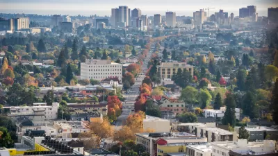
A mesmerizing presentation of the narrative arc of the United State’s 20 most populated metropolitan areas reveals the evolving weave of interrelationships that make up the country's urban settlements.

Chris Cillizza shares a graph originally posted on Peakbagger.com that charts the population of the top 20 metro areas in the United States between 1790-2010.
Cillizza points out that even more compelling than the claims of superiority often made by cities near the top of the list are the stories of the cities who have tumbled down the rankings, like Detroit (once #4) and Baltimore (once #3). Baltimore, at least, recently saw its first increase in population in 50 years.
Another detail revealed by the graph is evidence of the country’s agrarian past. For instance, in 1790 Salem, Massachusetts, was #5 and Charleston, South Carolina, was #4.
FULL STORY: The 20 most populous metro areas in the United States, in 1 amazing chart


Detroit and Michigan on the Upswing
It's been 66 years since the Motor City last grew its population. Census data released last month revealed an increase of nearly 2,000 people last year, nearly half the state's population growth.

The 15 Fastest-Growing Cities in the US
The U.S. Census Bureau released new 2023 population estimates on May 16 showing a slew of data for cities of all sizes and regions. Do you know the population change last year for the 15 largest cities in your state?
California Exodus: Population Drops Below 39 Million
Never mind the 40 million that demographers predicted the Golden State would reach by 2018. The state's population dipped below 39 million to 38.965 million last July, according to Census data released in March, the lowest since 2015.

Alabama: Trump Terminates Settlements for Black Communities Harmed By Raw Sewage
Trump deemed the landmark civil rights agreement “illegal DEI and environmental justice policy.”

Study: Maui’s Plan to Convert Vacation Rentals to Long-Term Housing Could Cause Nearly $1 Billion Economic Loss
The plan would reduce visitor accommodation by 25% resulting in 1,900 jobs lost.

Planetizen Federal Action Tracker
A weekly monitor of how Trump’s orders and actions are impacting planners and planning in America.

Study Links Covid and Poor Driving
The effects of the virus, including ‘brain fog,’ can make driving more difficult and dangerous.

Waymo Gets Permission to Map SF’s Market Street
If allowed to operate on the traffic-restricted street, Waymo’s autonomous taxis would have a leg up over ride-hailing competitors — and counter the city’s efforts to grow bike and pedestrian on the thoroughfare.

Parklet Symposium Highlights the Success of Shared Spaces
Parklets got a boost during the Covid-19 pandemic, when the concept was translated to outdoor dining programs that offered restaurants a lifeline during the shutdown.
Urban Design for Planners 1: Software Tools
This six-course series explores essential urban design concepts using open source software and equips planners with the tools they need to participate fully in the urban design process.
Planning for Universal Design
Learn the tools for implementing Universal Design in planning regulations.
Caltrans
Smith Gee Studio
Institute for Housing and Urban Development Studies (IHS)
City of Grandview
Harvard GSD Executive Education
Toledo-Lucas County Plan Commissions
Salt Lake City
NYU Wagner Graduate School of Public Service