


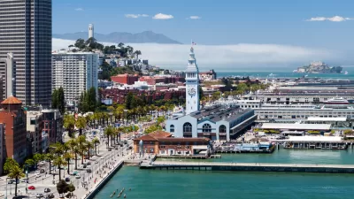
From a giant dam across the Golden Gate to a dozen "ventilated levees," the options proposed for protecting San Francisco Bay from rising seas are neither cheap nor subtle. But with sea level rise "around the corner," hard choices must be made.
The oldest continually operating tidal gauge in the Americas indicates that the waters of San Francisco Bay have risen 8 inches in the past century. That gradual rise is nothing compared to the predicted rise of an additional 1 1/2 feet by 2050 and 6 feet by 2100. Due to such a sea surge, "land equivalent in area to six San Franciscos could regularly flood, inundating vast swaths of the region's airports, high-tech campuses and the homes of more than 100,000 residents, according to the San Francisco Bay Conservation and Development Commission."
"Ultimately," reports James Temple, "there are few good options for confronting this challenge."
"'There are two reactions to dealing with sea level rise; there is fight and there is flight,'" said Will Travis, senior adviser to the Bay Area Joint Policy Committee, which coordinates planning efforts among regional agencies." According to Temple, "planners studying this issue believe that the realities of time, finances, politics and lethargy may force the region to make hard choices about what to protect, what to abandon and what level of risk the region is willing to live with."
Although some believe we don't know enough about the Bay Area's long-term vulnerabilities to seriously consider major protection projects, the reality is that "areas along San Francisco's Embarcadero, Peninsula beaches and, of course, Richardson Bay are already flooding with growing frequency."
"This won't be a problem that starts in 2050;" says Temple, "it's here, and will get worse over time."
FULL STORY: Preparing the bay for rising sea levels

Report: Embarcadero Needs to Rise 7 Feet to Resist Sea-Level Rise
A bombshell report details the adaptation measures that will be necessary to keep San Francisco's Embarcadero high and dry as the climate changes and sea levels rise.
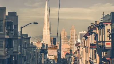
Opinion: High-Rises Won't Sink San Francisco
The weight of large buildings may not be a major threat to coastal cities, despite recent claims.
The Cost of Sea-Level Rise Measured in Tens of Billions in California
A new report summarizes the impact rising sea levels would have on California residents, businesses, and infrastructure. The effects would be catastrophic for the San Francisco Bay Area.

Alabama: Trump Terminates Settlements for Black Communities Harmed By Raw Sewage
Trump deemed the landmark civil rights agreement “illegal DEI and environmental justice policy.”

Study: Maui’s Plan to Convert Vacation Rentals to Long-Term Housing Could Cause Nearly $1 Billion Economic Loss
The plan would reduce visitor accommodation by 25% resulting in 1,900 jobs lost.

Why Should We Subsidize Public Transportation?
Many public transit agencies face financial stress due to rising costs, declining fare revenue, and declining subsidies. Transit advocates must provide a strong business case for increasing public transit funding.

Wind Energy on the Rise Despite Federal Policy Reversal
The Trump administration is revoking federal support for renewable energy, but demand for new projects continues unabated.

Passengers Flock to Caltrain After Electrification
The new electric trains are running faster and more reliably, leading to strong ridership growth on the Bay Area rail system.

Texas Churches Rally Behind ‘Yes in God’s Back Yard’ Legislation
Religious leaders want the state to reduce zoning regulations to streamline leasing church-owned land to housing developers.
Urban Design for Planners 1: Software Tools
This six-course series explores essential urban design concepts using open source software and equips planners with the tools they need to participate fully in the urban design process.
Planning for Universal Design
Learn the tools for implementing Universal Design in planning regulations.
Caltrans
Smith Gee Studio
Institute for Housing and Urban Development Studies (IHS)
City of Grandview
Harvard GSD Executive Education
Toledo-Lucas County Plan Commissions
Salt Lake City
NYU Wagner Graduate School of Public Service