


The subject of a recent summit hosted by software maker Esri, Larry Greenemeier explains the application of Geodesign to help predict and manage the increasingly complex intersection of design, land use, ecology, and climate change.
"Geodesign is an approach to city planning, land use and natural resource management that takes into account the tendency in recent years to overdevelop land at the expense of natural habitats, as well as population growth and climate change, which have left communities increasingly vulnerable to natural disasters," explains Greenemeier, who considers whether the design framework could help protect us from natural disasters like Superstorm Sandy.
Utilizing the advances in information collection, analysis, and visualization made possible by GIS, Geodesign provides the framework to "understand our landscape and [the] impact of our design decisions,” says Tom Fisher, dean of the University of Minnesota’s College of Design.
"Careful study of GIS data—which includes weather data but also takes into account population demographics, land use and a variety of other factors—could uncover clues about the likely intensity and impact of future storms as well as the extent to which zoning decisions can mitigate potential damage, according to Fisher, the emcee and moderator of this week’s Geodesign Summit hosted by GIS mapping software maker Esri at the company’s Redlands, Calif., headquarters."
Greeenemeier concludes with a short description of some of the innovative geodesign projects underway throughout the U.S.
FULL STORY: What Is Geodesign–and Can It Protect Us from Natural Disasters?

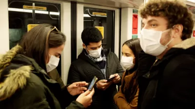
Esri Sets Up COVID-19 GIS Hub
The planning profession can contribute to the worldwide fight to control the spread of COVID-19. GIS technology, for instance, allows real-time monitoring of the pandemic.
Geocoding the Health Impacts of Your Neighborhood
Ever wonder what effect the pollution you're exposed to in your neighborhood on a daily basis is having on your family's long-term health? The emerging field of geo-medecine is providing answers, reports Christine MacDonald.
Rumor: Microsoft To Buy ESRI?
So if both Microsoft and ESRI are concerned about the Google's move into mapping with the impressive Google Earth, then perhaps a Microsoft-ESRI combination would be the way to fight back. Wow. That's a big rumor.

Alabama: Trump Terminates Settlements for Black Communities Harmed By Raw Sewage
Trump deemed the landmark civil rights agreement “illegal DEI and environmental justice policy.”

Study: Maui’s Plan to Convert Vacation Rentals to Long-Term Housing Could Cause Nearly $1 Billion Economic Loss
The plan would reduce visitor accommodation by 25% resulting in 1,900 jobs lost.

Planetizen Federal Action Tracker
A weekly monitor of how Trump’s orders and actions are impacting planners and planning in America.

This Toronto Suburb Has More Bus Riders Than Columbus, Ohio
Brampton, Ontario used gradual improvements in service to prove that if you build it, they will ride.

Paris Bike Boom Leads to Steep Drop in Air Pollution
The French city’s air quality has improved dramatically in the past 20 years, coinciding with a growth in cycling.

Why Housing Costs More to Build in California Than in Texas
Hard costs like labor and materials combined with ‘soft’ costs such as permitting make building in the San Francisco Bay Area almost three times as costly as in Texas cities.
Urban Design for Planners 1: Software Tools
This six-course series explores essential urban design concepts using open source software and equips planners with the tools they need to participate fully in the urban design process.
Planning for Universal Design
Learn the tools for implementing Universal Design in planning regulations.
Smith Gee Studio
Alamo Area Metropolitan Planning Organization
City of Santa Clarita
Institute for Housing and Urban Development Studies (IHS)
City of Grandview
Harvard GSD Executive Education
Toledo-Lucas County Plan Commissions
Salt Lake City
NYU Wagner Graduate School of Public Service