


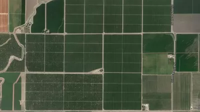
Ever get frustrated looking for the right aerial image of your project site on Google Earth? Emily Badger has found the solution - a DIY balloon mapping kit developed by cartographer Stewart Long.
As Badger reports, the $95 DIY balloon mapping kit sold by the Public Laboratory for Open Technology and Science, has several advantages over the typical aerial image found on Google Maps or Google Earth. For one, you can capture images at higher resolution. "At this distance," says Badger, "you can get down to the centimeter, enough to capture the dotted lines on a road, or the tiles on a roof." You can also update images as necessary to document changing conditions.
"The whole idea is an ingenious mix of high and low tech, of rubber bands
and helium and open-source software (Public Labs also has a platform
called MapKnitter that will help
you stitch the images together into one big mosaic). But aside from its
basic techie appeal, this tool is trying to take map-making – for
centuries the province of people who are in charge – and give the rest
of us that power, too."
FULL STORY: The Future of Aerial Mapmaking: Cheap Helium Balloons


Friday Eye Candy: 195 Gigapixels of Urban Glory
An incredibly detailed bird's eye view of Shanghai.

New Research Methods Help Nebraska's Water Management Plan
Researchers at the University of Nebraska have been working with the Nebraska Department of Natural Resources to develop best practices for predicting and planning for the future water needs of urban developments.
Friday Eye Candy: Where U.S. Roads Correct the Grid
Anyone who has traveled long country roads is familiar with the moment when a road makes a sharp turn to deviate from a direct path. Such "grid corrections" provide the subject for a photography project by Gerco de Ruijter.

Alabama: Trump Terminates Settlements for Black Communities Harmed By Raw Sewage
Trump deemed the landmark civil rights agreement “illegal DEI and environmental justice policy.”

Study: Maui’s Plan to Convert Vacation Rentals to Long-Term Housing Could Cause Nearly $1 Billion Economic Loss
The plan would reduce visitor accommodation by 25% resulting in 1,900 jobs lost.

Planetizen Federal Action Tracker
A weekly monitor of how Trump’s orders and actions are impacting planners and planning in America.

Waymo Gets Permission to Map SF’s Market Street
If allowed to operate on the traffic-restricted street, Waymo’s autonomous taxis would have a leg up over ride-hailing competitors — and counter the city’s efforts to grow bike and pedestrian on the thoroughfare.

Parklet Symposium Highlights the Success of Shared Spaces
Parklets got a boost during the Covid-19 pandemic, when the concept was translated to outdoor dining programs that offered restaurants a lifeline during the shutdown.

Federal Homelessness Agency Places Entire Staff on Leave
The U.S. Interagency Council on Homelessness is the only federal agency dedicated to preventing and ending homelessness.
Urban Design for Planners 1: Software Tools
This six-course series explores essential urban design concepts using open source software and equips planners with the tools they need to participate fully in the urban design process.
Planning for Universal Design
Learn the tools for implementing Universal Design in planning regulations.
Caltrans
Smith Gee Studio
Institute for Housing and Urban Development Studies (IHS)
City of Grandview
Harvard GSD Executive Education
Toledo-Lucas County Plan Commissions
Salt Lake City
NYU Wagner Graduate School of Public Service