


Earlier this week we brought you stunning images of global urban growth as captured by Landsat, NASA's longest running satellite imagery program. These images capture the dramatic changes to some of America's natural landscapes.
In 1972, NASA was gearing up to launch the Landstat satellite, and Americans were waking up to the fact that the landscape was changing really, really fast. To celebrate the 40th anniversary of the Landstat launch, NASA took nominations for areas that have undergone great change over the last four decades, and released customized images of their transformation, as seen from space.
The images include both urban and natural areas, the latter of which are no less transformed than the former. Although the greatest change in Lee County, Florida, came from development, the transformation of Trinity County, California was driven by logging. In North Central Colorado, the images focus on the impact of fire suppression and pine beetle outbreaks on forest lands.
NASA has also released a tutorial to allow data geeks to run their own queries, as well as imagery of dramatically transformed regions around the globe. These include Dubai and the Pearl River Delta in China, whose transformation from from an agricultural backwater to an industrial (and pollution) powerhouse of 36 million residents is captured in eerily beautiful swirls of reds and blues.
Thanks to Rachel Proctor May
FULL STORY: Watch the American Landscape Change as Seen from Space


What Does Sustainability Mean in Space?
NASA is developing a sustainability strategy to clean up space debris and plan for the future as near-earth orbit becomes more cluttered.
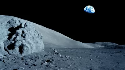
Train on the Moon? US to Explore Lunar Railway
Program proponents say this “visionary” endeavor “heralds a new era of human presence and economic activity beyond Earth.”
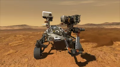
Mars Perseverance Rover and the Future Colonization of Mars
The 2020s is the decade of Mars. Last week NASA's Perseverance rover became the sixth American robot to land on the red planet, and the third visitor this month. Where are we going with Mars, who will get us there, and what is the ultimate goal?

Alabama: Trump Terminates Settlements for Black Communities Harmed By Raw Sewage
Trump deemed the landmark civil rights agreement “illegal DEI and environmental justice policy.”

Planetizen Federal Action Tracker
A weekly monitor of how Trump’s orders and actions are impacting planners and planning in America.

How Atlanta Built 7,000 Housing Units in 3 Years
The city’s comprehensive, neighborhood-focused housing strategy focuses on identifying properties and land that can be repurposed for housing and encouraging development in underserved neighborhoods.

In Both Crashes and Crime, Public Transportation is Far Safer than Driving
Contrary to popular assumptions, public transportation has far lower crash and crime rates than automobile travel. For safer communities, improve and encourage transit travel.

Report: Zoning Reforms Should Complement Nashville’s Ambitious Transit Plan
Without reform, restrictive zoning codes will limit the impact of the city’s planned transit expansion and could exclude some of the residents who depend on transit the most.

Judge Orders Release of Frozen IRA, IIJA Funding
The decision is a victory for environmental groups who charged that freezing funds for critical infrastructure and disaster response programs caused “real and irreparable harm” to communities.
Urban Design for Planners 1: Software Tools
This six-course series explores essential urban design concepts using open source software and equips planners with the tools they need to participate fully in the urban design process.
Planning for Universal Design
Learn the tools for implementing Universal Design in planning regulations.
Jessamine County Fiscal Court
Caltrans
Institute for Housing and Urban Development Studies (IHS)
City of Grandview
Harvard GSD Executive Education
Toledo-Lucas County Plan Commissions
Salt Lake City
NYU Wagner Graduate School of Public Service